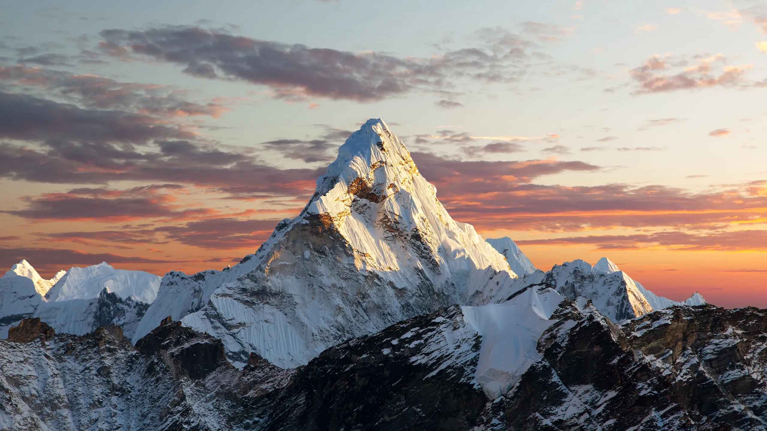
The Majesty of Mountain Peaks
Mountain peaks are nature’s grand sculptures, rising majestically above the surrounding landscape. In India, these towering summits play a crucial role in shaping the country’s geography, culture, and ecosystems. Here’s why they matter:
- Geological Formation:
- India’s mountain ranges, including the Himalayas, Western Ghats, and Eastern Ghats, owe their existence to tectonic forces.
- The collision between the Indian Plate and the Eurasian Plate uplifted these peaks over millions of years.
- These mountains act as natural barriers, influencing weather patterns, river courses, and biodiversity.
- Water Source:
- Mountain peaks are the primary source of rivers that sustain life across India.
- Glacial meltwater from peaks like Kanchenjunga and Nanda Devi feeds rivers like the Ganges, Yamuna, and Brahmaputra.
- These rivers provide water for agriculture, drinking, and industrial use.
- Cultural Significance:
- Mountain peaks hold immense spiritual and cultural value.
- Pilgrimage sites like Amarnath, Hemkund Sahib, and Badrinath are nestled in the Himalayas.
- Legends, myths, and rituals are woven around these peaks, connecting people to their heritage.
- Biodiversity Hotspots:
- High-altitude ecosystems support unique flora and fauna.
- Rare species like the snow leopard, Himalayan monal, and blue poppy thrive in these harsh environments.
- Conservation efforts focus on preserving these fragile habitats.
- Tourism and Adventure:
- Mountain tourism attracts trekkers, climbers, and nature enthusiasts.
- Peaks like Kanchenjunga and Nanda Devi offer challenging expeditions.
- Adventure sports like paragliding and skiing thrive in mountain regions.
In summary, India’s mountain peaks are not just geological features; they are guardians of life, culture, and natural beauty. Their towering presence continues to shape the nation’s identity and inspire awe in all who behold them.
The Himalayan Range: Abode of Giants
The Himalayas, also known as the “abode of snow,” form a majestic mountain range in Asia. These towering peaks separate the vast plains of the Indian subcontinent from the high Tibetan Plateau. Here are some key points about this remarkable range:
- Geographical Extent:
- The Himalayas stretch approximately 2,400 kilometers (1,500 miles) from west to east.
- They span five countries: Nepal, China, Pakistan, Bhutan, and India.
- From Jammu and Kashmir in the northwest to Arunachal Pradesh in the northeast, the Himalayas cover a vast expanse.
- Highest Peaks:
- The Himalayas boast more than 110 peaks that rise to elevations exceeding 7,300 meters (24,000 feet) above sea level.
- Among these peaks, Mount Everest (known as Sagarmatha in Nepali and Chomolungma in Tibetan) stands as the world’s highest point, soaring to an impressive 8,849 meters (29,032 feet).
- Formation and Significance:
- The Himalayas owe their existence to the collision between the Indian tectonic plate and the Eurasian Plate.
- This ongoing tectonic activity has shaped the Himalayan mountain range over millions of years.
- The mountains play a crucial role in shaping regional climates, influencing river systems, and supporting diverse ecosystems.
- Cultural and Spiritual Importance:
- For millennia, the Himalayas have held profound significance for the peoples of South Asia.
- Hinduism and Buddhism consider many Himalayan peaks sacred.
- Pilgrims and mountaineers alike have been drawn to these glaciated heights.
- Challenges and Exploration:
- The Himalayas pose both attraction and challenge to mountaineers worldwide.
- Some peaks, such as Kangchenjunga and Gangkhar Puensum, remain off-limits to climbers.
- The range’s rugged terrain and extreme altitudes demand resilience and skill.
Kanchenjunga: The Crown Jewel
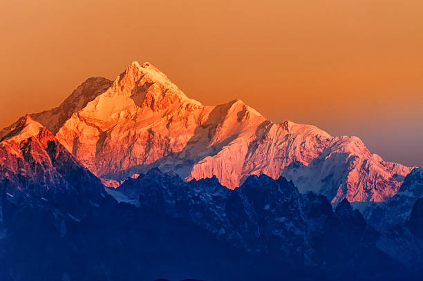
- Height and Location:
- Kanchenjunga, also spelled as Kangchenjunga stands at an awe-inspiring height of 8,586 meters (28,169 feet).
- It is the third-highest mountain in the world.
- Located in the eastern Himalayas, Kanchenjunga straddles the border between Sikkim state in northeastern India and eastern Nepal.
- Geography and Boundaries:
- The Kangchenjunga Himal region surrounds this majestic peak.
- It is bounded by the Tamur River (west), Lhonak River and Jongsang La (north), and the Teesta River (east).
- Three of its five peaks—Main, Central, and South—are directly on the border.
- Historical Significance:
- Until 1852, Kanchenjunga was believed to be the highest mountain globally.
- However, measurements by the Great Trigonometrical Survey of India revealed that Mount Everest (then known as Peak XV) holds that title.
- Kanchenjunga remains a sacred mountain in Nepal and Sikkim.
- First Ascent:
- On May 25, 1955, Joe Brown and George Band achieved the first ascent of Kanchenjunga.
- They stopped just short of the true summit, honoring a promise to the Chogyal of Sikkim that the top would remain inviolate.
- Biodiversity and Treks:
- Kanchenjunga is part of the Great Himalaya Range.
- Its pristine forests are home to rare species like the elusive snow leopard, red panda, and Himalayan monal pheasant.
- Trekkers can explore thrilling routes, including the Kanchenjunga Base Camp trek.
Nanda Devi: A Sanctuary of Biodiversity
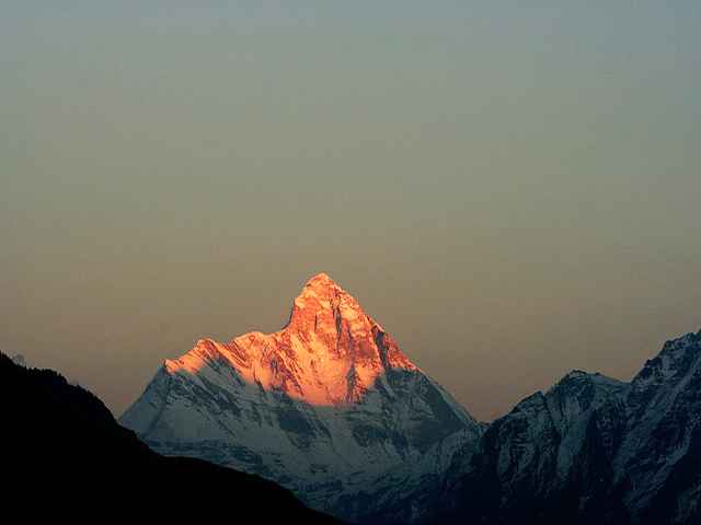
1. Nanda Devi Overview:
- Height: Nanda Devi stands at an impressive elevation of 7,816 meters (25,643 feet).
- It is the second-highest mountain in India, surpassed only by Kangchenjunga (which straddles the India-Nepal border).
- Notably, Nanda Devi is the highest peak in India.
2. Geography and Significance:
- Located in the Chamoli district of Uttarakhand, Nanda Devi lies between the Rishiganga valley (west) and the Goriganga Valley (east).
- Its name translates to “Bliss-Giving Goddess,” reflecting its revered status in local folklore.
- Nanda Devi is part of the Garhwal Himalaya range.
3. Nanda Devi Sanctuary:
- The mountain’s interior forms the Nanda Devi Sanctuary, a pristine and almost insurmountable ring.
- This sanctuary is protected as the Nanda Devi National Park.
- Within this sacred space, Nanda Devi East (also known as Sunanda Devi) lies on the eastern edge.
4. Biodiversity and Conservation:
- Nanda Devi’s slopes harbor a rich variety of flora and fauna.
- Rare species like the elusive snow leopard, red panda, and Himalayan monal pheasant find refuge here.
- In recognition of its ecological importance, the Indian government declared Nanda Devi off-limits to both locals and climbers in 1983.
- The surrounding Nanda Devi National Park is a UNESCO World Heritage Site.
Kamet: Gateway to the Garhwal Himalayas
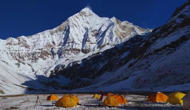
1. Kamet Overview:
- Kamet is the second-highest mountain in the Garhwal region of India, following Nanda Devi.
- It stands at an impressive elevation of 7,756 meters (25,446 feet).
- Located in the Chamoli District of Uttarakhand, Kamet lies close to the border with Tibet.
2. Unique Features:
- Kamet’s appearance resembles a giant pyramid crowned by a flat summit area with two peaks.
- Due to its proximity to the Tibetan Plateau, Kamet is remote and less accessible than some other Himalayan peaks.
- Despite its height, it offers a relatively straightforward ascent by modern standards.
3. Significance:
- Kamet holds importance among mountaineers and climbers due to its challenging terrain and elevation.
- Wind from the Tibetan Plateau adds to the mountain’s allure.
Lesser-Known Gems
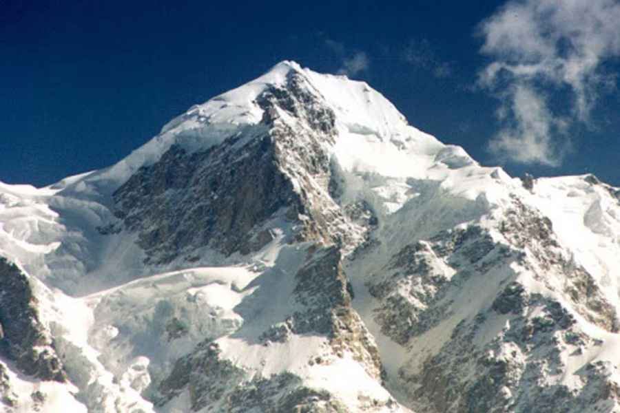
- Saltoro Kangri:
- Elevation: Saltoro Kangri stands at an impressive 7,742 meters (25,400 feet).
- Location: It is part of the Saltoro Mountains, which form a subrange within the Karakoram Range.
- Siachen Glacier: Saltoro Kangri lies on the southwest side of the Siachen Glacier, one of the world’s longest glaciers outside the polar regions.
- Actual Ground Position Line (AGPL): The Saltoro Mountains straddle the border between Indian and Pakistani-controlled territories. India controls the high peaks and passes, while Pakistan occupies the lower valleys to the west.
- Biodiversity: Despite its dramatic peaks, Saltoro Kangri remains rarely visited due to the ongoing Siachen Conflict.
- River Connection: The Saltoro Mountains drop steeply to the valleys of the Kondus and Dansam Rivers, which eventually flow into the Indus River.
- Saser Kangri:
- Elevation: Saser Kangri, also known as Sasir Kangri, reaches a height of 7,672 meters (25,171 feet).
- Location: It is the highest peak in the Saser Muztagh, the easternmost subrange of the Karakoram range, located within Ladakh.
- Yellow Snow Mountain: The name “Saser Kangri” translates to “Yellow Snow Mountain” in Ladakhi.
- Massif Peaks:
- Saser Kangri I: Ranked 35th globally, it boasts a prominence of 2,304 meters.
- Saser Kangri II (East): Ranked 49th, with a prominence of 1,450 meters.
- Saser Kangri III: Ranked 51st, with a prominence of 850 meters.
- And more peaks within the massif.
- Climbing History: The first ascent of Saser Kangri occurred in 1973 from the southeast, a challenging route. Climbers later succeeded in ascending it from the western side in 1987.
- Breathtaking Views: Saser Kangri offers stunning vistas of the Nubra Valley and the Tibetan Plateau.
Conservation Efforts and Challenges
1. Biodiversity Conservation in Fragile Ecosystems:
- Fragile ecosystems, such as the Buxa Tiger Reserve (BTR) in the Eastern Himalayan foothills, face significant threats to biodiversity conservation.
- Rising summer temperatures and decreasing annual precipitation between 1990 and 2021 have led to forest dryness, water scarcity, and forest fires in BTR.
- Natural disasters like floods, flash floods, earthquakes, and landslides also damage wildlife habitats.
- Land use changes (including encroachment), infrastructure development, fuelwood collection, and grazing practices alter ecosystems.
- Hunting and poaching pose threats to wildlife populations in the reserve.
2. Climate Change Impact:
- Rising global temperatures affect ecosystems worldwide.
- In BTR, climate change exacerbates forest dryness, water scarcity, and wildfires.
- Adaptation strategies are crucial to mitigate these effects.
3. Tourism Impact:
- Tourism contributes to greenhouse gas emissions and environmental strain.
- During peak tourist seasons, fragile ecosystems experience increased pressure.
- Stringent policies are needed to manage tourism sustainably.
- Promoting off-season tourism and adopting resilient infrastructure designs can help reduce environmental impact.
4. Overall Challenges:
- Protecting natural areas is essential for maintaining prosperity in a warming world.
- Currently, only a small percentage of land and oceans are protected.
- By 2030, we must double land and quadruple ocean protection to avoid catastrophic climate effects.
Trekking and Adventure
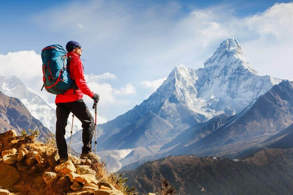
- Ranthan Kharak Trek:
- Location: Uttarkashi district, Uttarakhand, India.
- Highlights: Alpine forests, high-altitude meadows, and stunning peak views.
- Maximum Altitude: Around 13,120 feet (4,000 meters) at Ranthan Pass.
- Duration: 6-7 days.
- Best Time: May to June and September to October.
- Chirbatiya Trek:
- Starting Point: Chirbatiya village (1,800 meters above sea level).
- Highlights: Gradual altitude gain, Tali Top (3,380 meters), and Deoriatal Lake (2,438 meters).
- Notable Peak: Chaukhamba Peak (6,854 meters) is visible but not part of the trek.
- Bamsaru Khal Trek:
- Location: Chamoli district, Uttarakhand, India.
- Terrain: Alpine meadows, dense forests, and rocky paths.
- Highest Point: Bamsaru Khal Pass (4,700 meters).
- Challenge Level: Requires good fitness and endurance.


