


Hurricane Polo Reaches Category 5

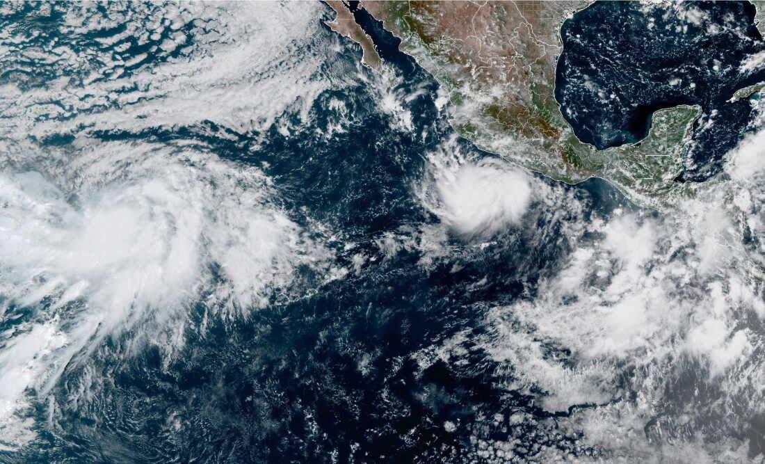
Hurricane Polo has again strengthened into a Category 5 hurricane while moving slowly off the Pacific coast of Mexico. The U.S. National Hurricane Center (NHC) reported on September 23 that Polo had regained Category 5 strength, with maximum sustained winds of about 160 mph (260 km/h). The storm was located roughly 145 miles (235 km) south-southwest of Zihuatanejo in Guerrero and was moving northwest.
Thank you for reading this post, don't forget to subscribe!Hurricane Polo Becomes a Powerful Pacific Storm
Polo first reached Category 5 strength on September 22 after a period of very rapid intensification. At one stage, the hurricane reached maximum sustained winds of around 180 mph (285 km/h), with a minimum central pressure of 892 millibars. Later, its winds weakened somewhat, but the system remained an extremely powerful hurricane.
The storm’s rapid development became one of the main weather stories in the eastern Pacific. NHC advisories described the strengthening as unusually fast. Polo went from a tropical storm to a Category 5 hurricane within about a day, showing how quickly tropical systems can intensify when atmospheric and ocean conditions are favourable.
Polo Remains Offshore of Mexico
The hurricane has remained offshore rather than making a direct landfall. The NHC said the core of Polo was expected to remain offshore of southwestern Mexico, although its outer bands were already affecting coastal areas. By the evening of September 23, the centre was about 130 miles (205 km) south of Zihuatanejo and 240 miles (390 km) southeast of Manzanillo.
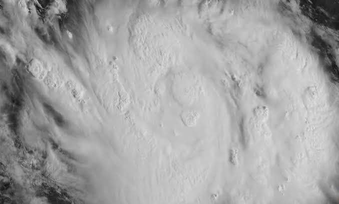
The storm was expected to turn toward the west-northwest and then move farther away from the Mexican coast. Even without a direct landfall, the hurricane posed risks because of its large wind field, heavy rain and rough ocean conditions.
Heavy Rain Threatens Southwestern Mexico
Rainfall has remained one of the biggest concerns for Mexico. Coastal areas of Guerrero were expected to receive several inches of rain, with locally higher amounts possible. Heavy rainfall can quickly cause flash flooding, especially in areas where water flows through steep or mountainous terrain.
The NHC also warned about possible mudslides in vulnerable areas. Guerrero, Michoacán, Colima and nearby parts of southwestern Mexico faced the effects of Polo’s outer rainbands and strong ocean conditions.
Dangerous surf and strong rip currents were another concern. Residents and visitors along the coast were advised to stay away from beaches and follow local safety instructions as the storm passed offshore.
Mexico Takes Safety Measures
Mexican authorities took several measures as Polo approached the Pacific coast. Ports were closed or restricted in parts of Guerrero and Michoacán, affecting shipping and smaller boats. Classes were also temporarily suspended in some coastal areas because of the weather threat.
Authorities also warned people not to walk or drive through flooded areas. Local emergency services prepared for possible flooding, mudslides and dangerous sea conditions. The U.S. Embassy in Mexico also advised its citizens to avoid beaches and water and follow instructions from Mexican authorities.
The precautions were especially important because Mexico’s Pacific coast has experienced major hurricane impacts in recent years, including Hurricane Otis, which struck Acapulco as a Category 5 storm in October 2023.
What Is a Category 5 Hurricane?
Category 5 is the highest category on the Saffir-Simpson Hurricane Wind Scale. It applies to hurricanes with maximum sustained winds of at least 157 mph, or about 252 km/h.
The scale measures wind strength and does not directly describe the amount of rainfall, flooding or storm surge produced by a hurricane. A storm below Category 5 can still cause severe damage through flooding, landslides, storm surge and other hazards.
Polo’s case also shows why hurricane warnings focus on more than wind speed. Even when a storm remains offshore, its rainbands and ocean effects can create dangerous conditions along the coast.
El Niño and Rapid Intensification
Hurricane Polo has also drawn attention because it developed during a period of strong El Niño conditions in the Pacific. El Niño involves unusually warm ocean temperatures in the central and eastern tropical Pacific and can influence weather patterns around the world.
Scientists have linked the favourable Pacific environment to the storm’s rapid strengthening, although the development of an individual hurricane depends on several factors, including ocean heat, atmospheric moisture and wind patterns.
Polo became the third Category 5 hurricane of the 2026 eastern Pacific season, following Genevieve and Lowell, according to reports citing National Hurricane Center data. Its rapid intensification placed it among the strongest Pacific storms seen in recent decades.
Polo’s Latest Position and Forecast
As of the latest September 23 NHC advisory, Hurricane Polo remained a Category 5 hurricane with maximum sustained winds of about 160 mph (260 km/h). The storm was moving northwest at roughly 6 mph (9 km/h), while the centre remained offshore of southwestern Mexico.
Forecasters expected Polo to gradually turn west-northwest and then move farther away from the Mexican coast. However, the storm remained capable of producing heavy rainfall, dangerous surf and tropical-storm conditions in parts of the southwestern coastline.