


QR Codes On Land Records In Odisha

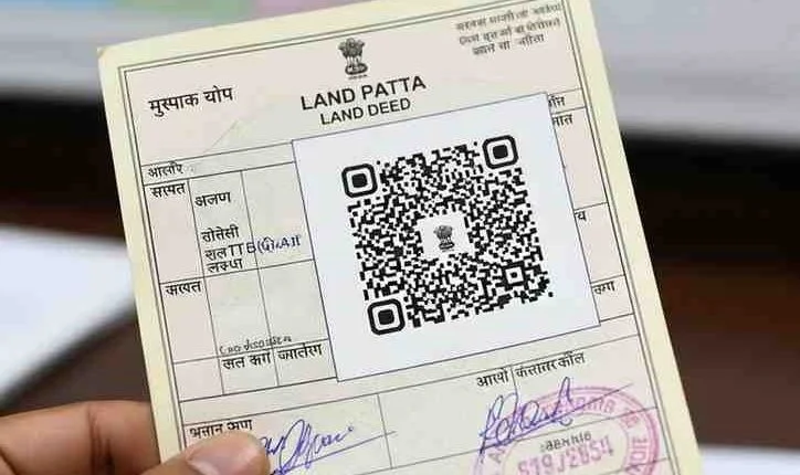
QR Codes On Land Records will soon change how people verify property ownership in Odisha. The state government has announced that all land ownership documents will carry QR codes that can be scanned to instantly access complete property details. This step aims to make land transactions safer, faster, and more transparent.
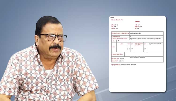
Thank you for reading this post, don't forget to subscribe!The announcement was made by Revenue and Disaster Management Minister Suresh Pujari, who said the system will modernize how land information is stored and shared. Each land patta, also known as the Record of Rights (RoR), will contain a unique QR code linked to a secure digital database.
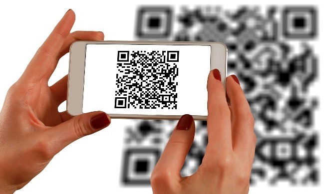
With one scan using a smartphone, buyers, sellers, officials, or banks will be able to check ownership, location, land use, and transaction history without visiting government offices.
QR Codes On Land Records Provide Instant Access To Complete Property Details
Buying land often involves complicated paperwork and long verification processes. Currently, buyers depend on documents such as encumbrance certificates issued by local offices. These certificates usually show registered transactions only for the past 30 years.
The new QR-based system will go far beyond this limitation.
When the QR code on a land document is scanned, it will display:
- Current owner details
- Exact location of the property
- Parcel map showing boundaries
- Land classification and usage
- Irrigation status
- Details of neighboring plots
- Full transaction history
This means buyers can verify whether the seller truly owns the land and whether any disputes or prior sales exist. The system will reduce uncertainty and help people make informed decisions.
QR Codes On Land Records Reduce Fraud And Illegal Sales
Land fraud is a serious issue in many parts of India. Fake documents, multiple sales of the same property, and unauthorized transfers often lead to long legal battles.
By linking each document to a secure digital record, Odisha aims to eliminate such risks.
Officials say the QR-enabled documents will be tamper-proof. Any attempt to modify records illegally will trigger alerts to revenue officers and local authorities. This real-time monitoring will make it much harder to manipulate ownership data.
The reform is expected to protect not only buyers but also genuine landowners whose properties might otherwise be targeted by fraudsters.
Digitally Generated And Secure Records
The new land pattas will be generated digitally rather than manually prepared. This reduces human errors and prevents document forgery.
Every updated Record of Rights will include a detailed profile of the land parcel. In addition to ownership data, it will also show how the land is classified for example, agricultural, residential, or commercial.
This information is important because land-use restrictions can affect construction permissions, taxation, and resale value.
Digital records also make it easier for government agencies to coordinate planning activities such as infrastructure development, disaster management, and environmental protection.
Integration With National Modernization Efforts
Odisha’s initiative is part of a larger nationwide effort to modernize land administration under the Digital India Land Records Modernisation Programme (DILRMP). The program focuses on digitizing land records, updating surveys, and linking textual data with maps.
Since most of Odisha’s land records have already been digitized, adding QR codes represents the next stage of reform.
Authorities plan to conduct a comprehensive land survey to verify both government and private holdings. This survey will use advanced tools such as:
- High-resolution satellite imagery
- Official survey maps
- Cadastral data from revenue departments
- Geographic Information System (GIS) technology
All this information will be integrated into a single digital platform, creating a unified land database for the entire state.
GIS Mapping For Accurate Land Identification
One of the biggest challenges in land management is accurately identifying boundaries. Traditional maps can be outdated or unclear, leading to disputes between neighbors.
Under the new system, each land parcel will be digitally mapped as a closed shape on a GIS platform. Every plot will have a unique identification number linked directly to its ownership record.
When someone scans the QR code, they will see both the map and the textual details together. This combination makes verification far more reliable than relying on paper documents alone.
Accurate mapping also helps in urban planning, road construction, irrigation projects, and disaster response planning.
Faster Property Transactions
Property transactions often take weeks or months due to the time required for verification and approvals. Buyers must visit multiple offices, collect documents, and wait for officials to confirm records.
QR-based verification can significantly speed up this process.
Banks can quickly confirm ownership before approving loans. Government agencies can process registrations faster. Buyers and sellers can complete deals with greater confidence.
In today’s fast-moving real estate market, such efficiency is becoming increasingly important.
Benefits For Rural And Urban Areas
The reform is expected to benefit both rural farmers and urban property owners.
In rural areas, land is often the primary source of livelihood. Clear ownership records help farmers access loans, government schemes, and insurance benefits.
In cities, accurate records support planned development and reduce disputes related to housing and commercial projects.
Digital access also reduces the need for frequent visits to government offices, saving time and travel costs especially important for people living in remote areas.
Supporting Transparent Governance
Transparent land records are essential for good governance. They help prevent corruption, improve tax collection, and ensure fair distribution of resources.
With QR-enabled documents, officials can quickly verify information during inspections or administrative processes. This reduces paperwork and improves accountability.
The system also aligns with broader digital transformation efforts across India, where governments are increasingly using technology to deliver public services more efficiently.
QR Codes On Land Records Preparing For Future Digital Services
Experts believe QR-coded land records could enable additional services in the future. For example:
- Online property transfers
- Integration with banking systems
- Automated tax calculations
- Disaster compensation processing
- Smart city planning tools
As digital infrastructure expands, land data could become part of larger e-governance platforms connecting multiple departments.
This would create a seamless system where citizens can access services without navigating complex bureaucratic procedures.
QR Codes On Land Records Mark A Major Step Toward Modern Land Management
Odisha’s move to introduce QR codes on land records represents a significant shift from paper-based administration to a secure digital framework. By combining technology with accurate mapping and centralized databases, the state aims to make property ownership clearer and transactions safer.
The reform addresses long-standing challenges such as fraud, delays, and lack of transparency while supporting economic growth and development.
As implementation progresses, QR-enabled land documents could become a model for other states looking to modernize their land governance systems and build trust in property transactions across the country.