

Karbi Anglong District: History, Geography, Population, Culture and Tourist Places

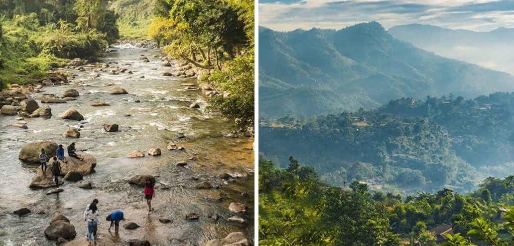
Karbi Anglong District is one of the most culturally diverse and geographically significant districts of Assam, located in the central part of the state. Known for its beautiful hills, dense forests, rivers, waterfalls and rich tribal heritage, the district represents an important part of Assam’s natural and cultural identity. It is home to several indigenous communities, including the Karbi people, who have preserved their traditional customs, languages, festivals and lifestyles over generations.
The district is also important from an administrative point of view because it enjoys special autonomy under the Sixth Schedule of the Indian Constitution. The Karbi Anglong Autonomous Council (KAAC) looks after several aspects of local administration and development.

Diphu, the district headquarters, is an important centre of administration, education, trade and cultural activities. From its historical formation to its natural attractions and agricultural economy, Karbi Anglong has an important place in the development of Assam.
Overview of Karbi Anglong District
Karbi Anglong is situated in the central part of Assam and is known for its extensive hilly landscape and forest resources. The region is mainly inhabited by tribal communities, although people from different cultural and linguistic backgrounds also live here.
The district was established as part of the United Mikir and North Cachar Hills District on 17 November 1951. It received its present name on 14 October 1976, when the Mikir Hills District was renamed Karbi Anglong.
The district originally covered an area of approximately 10,434 square kilometres. However, West Karbi Anglong was created as a separate district in 2016, with Hamren as its headquarters.
Important facts about Karbi Anglong District:
| Particulars | Details |
|---|---|
| State | Assam |
| Location | Central Assam |
| Present District Headquarters | Diphu |
| Historical Formation | 17 November 1951 |
| Renamed | 14 October 1976 |
| Autonomous Council | Karbi Anglong Autonomous Council |
| Constitutional Provision | Sixth Schedule |
| Major Indigenous Community | Karbi |
| Major Languages | Karbi, Assamese and others |
| Important Town | Diphu |
| Major Economic Activity | Agriculture |
| Famous Natural Attraction | Garampani Wildlife Sanctuary |
History of Karbi Anglong District
The history of Karbi Anglong is closely connected with the political, social and cultural development of the hill communities of Assam. Before British colonial rule, the Karbi people and other indigenous communities lived in their traditional settlements and maintained their own social and administrative systems.
Karbi Anglong During British Rule
During British administration, the Mikir Hills region underwent several administrative changes. The British government introduced different administrative arrangements to govern the hill areas and their indigenous populations.
Some important historical developments include:
- 1884: The Mikir Hills tract was brought under the administration of Nowgong (present-day Nagaon) district.
- 1893: The region was transferred to Sivasagar district for administrative purposes, according to the historical information supplied.
- Government of India Act, 1919: The hill region received special administrative treatment as a Backward Tract.
- Government of India Act, 1935: The area was classified as a Partially Excluded Area, providing a separate administrative arrangement.
These arrangements limited the direct application of certain general administrative and political provisions to the hill communities.
Formation of the United Mikir and North Cachar Hills District
After India’s independence, demands for greater administrative protection and development of the tribal hill communities became important.
On 17 November 1951, the United Mikir and North Cachar Hills District was formed by combining areas from the former districts of Sivasagar, Nagaon, Cachar and the United Khasi and Jaintia Hills region.
The district was created to support the development and administration of the indigenous communities living in the hill areas of central Assam.
The Autonomous District Council was subsequently established under the Sixth Schedule on 23 June 1952.
Renaming of Mikir Hills as Karbi Anglong
In 1970, the United Mikir and North Cachar Hills District was divided into two separate administrative districts:
- Mikir Hills District
- North Cachar Hills District, now known as Dima Hasao.
Later, on 14 October 1976, the Mikir Hills District was officially renamed Karbi Anglong District. Diphu became its headquarters.
Formation of West Karbi Anglong
In 2016, the former Karbi Anglong District was further divided through the creation of West Karbi Anglong District.
Hamren was selected as the headquarters of the new district, while Diphu continued to serve as the headquarters of Karbi Anglong.
This administrative division helped create separate district-level administrative arrangements for the two regions.
Geography of Karbi Anglong District
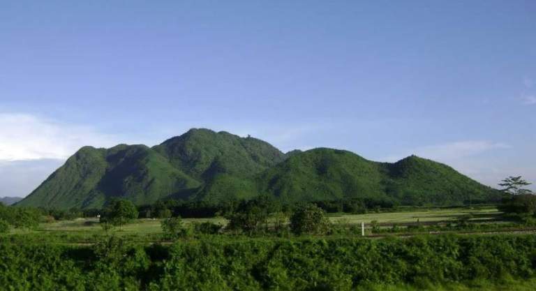
Karbi Anglong is known for its hills, valleys, forests, rivers and scenic landscapes. The Karbi Hills form an important part of its geographical identity.
The region has a combination of elevated hills, small valleys, agricultural plains and forest-covered areas. Its natural environment supports a wide range of plants and wildlife.
The historical undivided district covered approximately 10,434 square kilometres. This figure should not be confused with the geographical area of the present district after the creation of West Karbi Anglong.
Location and Boundaries
The broader Karbi Anglong hill region shares geographical connections with several districts and neighbouring states.
The region is associated with:
- North: Nagaon and Golaghat areas.
- South: Dima Hasao and parts of Nagaland.
- East: Golaghat and Nagaland.
- West: Meghalaya and the neighbouring districts of Assam.
The exact administrative boundaries differ between the present Karbi Anglong and West Karbi Anglong districts.
Hills and Highest Peak
The Karbi Hills dominate the landscape of the region. These hills are covered with forests and contain numerous valleys and streams.
Laru Peak, at approximately 1,290 metres above sea level, is identified as the highest peak in the broader Karbi Anglong hill region.
The hilly terrain makes the region suitable for nature tourism, trekking and outdoor exploration.
Climate of Karbi Anglong
Karbi Anglong experiences a humid subtropical climate. The weather changes according to the season and the elevation of different locations.
- Winter: Generally lasts from October to February. Temperatures in the hill region can range between 6°C and 12°C.
- Summer: Temperatures generally range between 23°C and 32°C.
- Monsoon: The region receives substantial rainfall, with an average annual rainfall of approximately 2,416 mm in the broader hill region.
The monsoon season supports agriculture and maintains the area’s forests, rivers and waterfalls.
Major Rivers of Karbi Anglong
Several rivers and streams flow through the Karbi Anglong region. They support agriculture, local settlements and natural ecosystems.
Some important rivers and waterways associated with the region include:
- Dhansiri River
- Jamuna River
- Dikharu River
- Dighalpani River
- Longlit River
- Kalini River
- Langfer River
- Kopili River
- Karbi Langpi River
These water resources are important for farming, local livelihoods and the environment.
Population and Demographics of Karbi Anglong District
Karbi Anglong has a diverse population consisting of several tribal and non-tribal communities. The Karbi people form an important indigenous community of the region.
According to the Census of India 2011, the former undivided Karbi Anglong District had a total population of 956,313. These figures include the area that later became West Karbi Anglong.
Population Details
| Particulars | Census 2011 |
|---|---|
| Total Population | 956,313 |
| Male Population | 490,167 |
| Female Population | 466,146 |
| Rural Population | 843,347 |
| Urban Population | 112,966 |
| Population Density | 92 persons per sq. km |
| Sex Ratio | 951 females per 1,000 males |
| Decadal Growth (2001–2011) | 17.58% |
| Child Population (0–6 years) | 151,681 |
| Child Sex Ratio | 959 girls per 1,000 boys |
Approximately 88.19% of the population lived in rural areas, while 11.81% lived in urban areas.
Literacy Rate
Education plays an important role in the social and economic development of Karbi Anglong.
The Census 2011 district profile recorded a literacy rate of approximately 69.25% for the undivided district. Different official statistical tables and later boundary-based calculations may show different figures, so the census boundary must be considered when comparing literacy data.
Scheduled Castes and Scheduled Tribes
Karbi Anglong has a significant tribal population. According to the 2011 Census figures for the undivided district:
- Scheduled Tribes (ST): Approximately 56.3%.
- Scheduled Castes (SC): Approximately 4.7%.
The Karbi community is one of the major indigenous communities of the region. Other communities include Dimasa, Bodo, Tiwa, Garo, Khasi, Kuki, Nepali and Adivasi communities.
Religious Composition
The population of Karbi Anglong follows different religious traditions. According to the 2011 Census profile of the undivided district, the major religious groups included:
- Hinduism: Approximately 80.1%.
- Christianity: Approximately 16.5%.
- Islam: Approximately 2.1%.
- Buddhism: Approximately 0.7%.
- Other religions and not stated: Remaining share.
These figures refer to the historical 2011 district boundaries and should not be treated as the present-day population composition of Karbi Anglong alone.
Culture and Traditional Festivals of Karbi Anglong
The culture of Karbi Anglong is closely connected with the traditions and lifestyle of its indigenous communities. The Karbi people have a rich cultural heritage expressed through their festivals, music, dance, traditional clothing, food and social customs.
Rongker Festival
Rongker is one of the important traditional festivals of the Karbi community. It is generally observed to seek protection, peace and prosperity for villages and their residents.
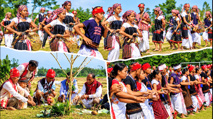
Traditional rituals are performed during the festival, reflecting the community’s relationship with nature and its traditional beliefs.
Chomangkan Festival
Chomangkan is a traditional Karbi death-related ceremony performed to honour deceased members of the community. It is an important cultural and social event involving rituals, music and traditional performances.
Traditional Music and Dance
Traditional music and dance are important parts of Karbi culture. Instruments such as the flute, drums and other traditional musical instruments are used during cultural celebrations.
The traditional dance forms and songs reflect the community’s history, agricultural activities and social life.
Socio-Economic Condition of Karbi Anglong District
Agriculture is one of the main sources of livelihood in Karbi Anglong. A large section of the rural population depends on farming and related activities.
Agriculture
The region’s fertile valleys and suitable climatic conditions support the cultivation of several crops.
Important agricultural products include:
- Rice
- Maize
- Ginger
- Turmeric
- Vegetables
- Pineapple
- Banana
- Other seasonal fruits
Traditional farming methods continue to play an important role in many rural communities.
Karbi Anglong Ginger: A Famous GI-Tagged Agricultural Product of Assam
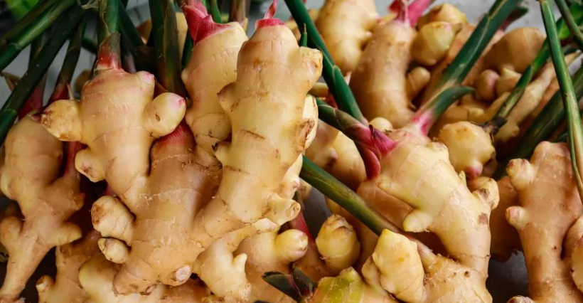
Karbi Anglong is famous for its distinctive Assam Karbi Anglong Ginger, cultivated mainly in the hilly areas, particularly around the Singhasan Hills. Known for its strong aroma, high pungency, flavour and traditional cultivation practices, this ginger is an important cash crop for local farming communities. Farmers traditionally use jhum and tila cultivation methods, with sowing generally taking place in March and April and harvesting around January. The two popular varieties are Nadia, which is more fibrous and mainly sold in domestic markets, and Aizol, which has lower fibre content and is associated with export markets. The ginger is marketed fresh, dried and in powdered form and is used in cooking, beverages and traditional medicine. It received Geographical Indication (GI) recognition in 2015, with application number 435 and certificate number 226, through the registered applicant NERAMAC. Its cultivation and marketing support local livelihoods and promote the agricultural heritage of Karbi Anglong. The product is also known for its commercial potential in domestic and international markets.
Livestock Farming
Livestock farming is another important economic activity. People raise cattle, goats, pigs and poultry for household consumption and income.
Small-Scale Industries
Small-scale industries and household enterprises provide additional employment opportunities.
Some important activities include bamboo and cane products, traditional weaving, handicrafts, food processing and other cottage industries.
Tourism
Tourism has considerable potential because of the region’s natural beauty, waterfalls, forests, hills and cultural heritage.
Nature tourism, village tourism and cultural tourism can contribute to local employment and economic development.
Administrative Setup of Karbi Anglong District
Karbi Anglong has a special administrative structure under the Sixth Schedule of the Indian Constitution.
The Karbi Anglong Autonomous Council (KAAC) is the principal autonomous governing body responsible for several local administrative and developmental matters.
Karbi Anglong Autonomous Council (KAAC)
The Karbi Anglong Autonomous Council was established under the constitutional provisions of the Sixth Schedule.
The Sixth Schedule provides special administrative arrangements for tribal areas in certain northeastern states, including Assam.
The Council has responsibilities relating to several important subjects, including:
- Agriculture
- Education
- Local infrastructure
- Forest management
- Public health
- Cultural preservation
- Rural development
The autonomous arrangement aims to protect the interests, traditions and development needs of indigenous communities.
District Headquarters and Sub-Divisions
Diphu is the administrative headquarters of Karbi Anglong District.
The district has administrative and development offices that look after public services, revenue administration, rural development and other government activities.
The major administrative centres and areas include Diphu and Bokajan. The district’s administrative structure also includes revenue circles and development blocks.
Tourist Places in Karbi Anglong District
Karbi Anglong has several natural and cultural attractions. Its hills, forests, waterfalls and traditional villages attract visitors interested in nature, photography and local culture.
Some of the notable tourist destinations include:
Garampani Wildlife Sanctuary
Garampani Wildlife Sanctuary is one of the important wildlife destinations associated with the Karbi Anglong region. It is known for its hot water spring, waterfalls and surrounding forest landscape.
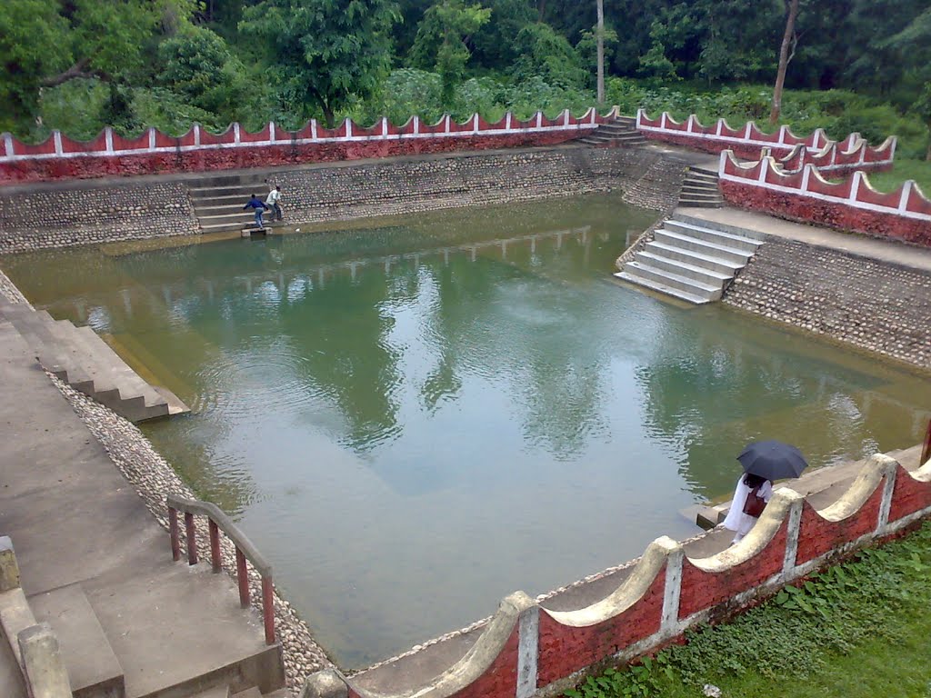
The sanctuary is surrounded by the Nambor forest area and supports different species of wildlife.
Visitors may find animals such as elephants, gaur, sambar deer, barking deer, hoolock gibbons and several bird species in the wider forest ecosystem.
The Assam Forest Department also identifies Garampani as one of the state’s older wildlife sanctuaries.
Khanduli
Khanduli is a scenic village near the Assam-Meghalaya border. It is known for its beautiful landscapes, traditional farming activities and indigenous cattle-breeding practices.
The natural surroundings and rural lifestyle make it an interesting destination for visitors who want to experience village life and the beauty of the hill region.
Deopani Durga Temple
Deopani Durga Temple is a religious attraction in Karbi Anglong. Dedicated to Goddess Durga, the temple is surrounded by greenery and tea gardens.
The peaceful environment makes it a place of religious and cultural importance for visitors and devotees.
Koko Falls
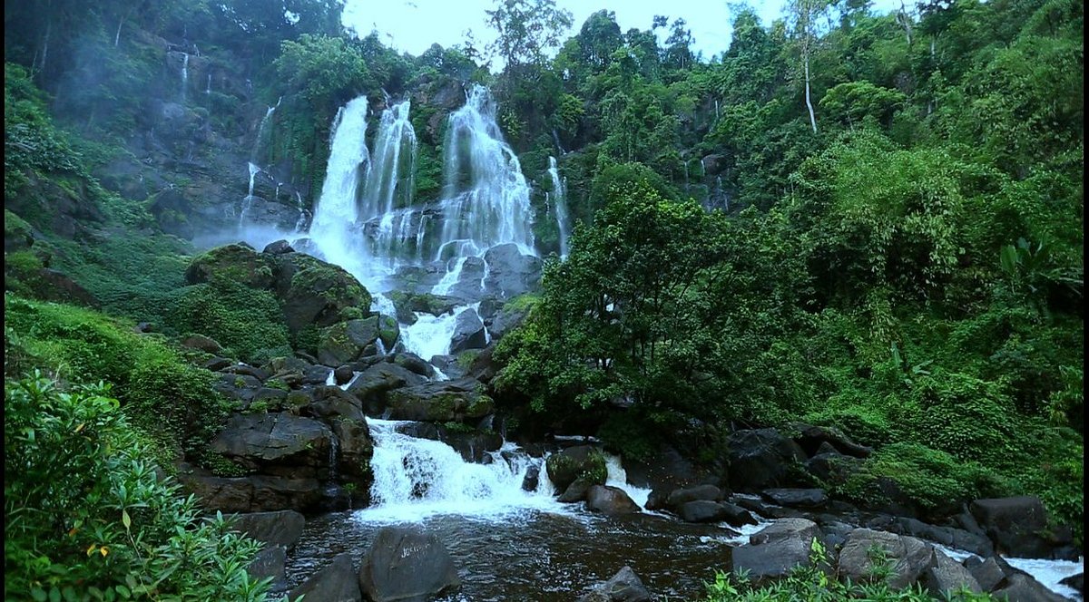
Koko Falls is a natural attraction known for its flowing water and green surroundings. The waterfall offers opportunities for photography and nature exploration.
Visitors should take care around slippery rocks, especially during and after the monsoon season.
Kokatheikhun Waterfall
Kokatheikhun Waterfall is another scenic destination associated with the forested landscape of Karbi Anglong.
Its cascading water, surrounding greenery and natural environment make it attractive to nature lovers and photography enthusiasts.
Longkam Ronghangpi Cave
Longkam Ronghangpi Cave is a natural cave known for its interesting rock formations.
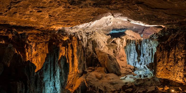
The cave offers opportunities for exploring underground geological features, including stalactites and stalagmites. Visitors should explore such locations carefully and avoid disturbing the natural formations.
Paklongkam Waterfalls
Paklongkam Waterfalls, located near the Bhelughat region, is surrounded by green vegetation and rocky landscapes.
The natural pool at the base of the waterfall adds to its scenic appeal. It is an interesting destination for visitors who enjoy exploring less-developed natural attractions.
Umwang
Umwang is known for its grassland landscape on top of a table-shaped hill. It is surrounded by a river and offers beautiful views of the surrounding natural environment.
The location is suitable for nature exploration, photography and trekking, depending on weather and local access conditions.
Transport and Connectivity in Karbi Anglong
Transport facilities connect Karbi Anglong with other parts of Assam and neighbouring states.
Roadways
Road transport is an important means of communication in the district. Diphu and other towns are connected through state highways and other major roads.
National Highway 39 is an important historical road reference for the region. The current road network and route numbers should be checked before travelling, as highway numbering has changed over time.
Railways
Rail connectivity is important for passengers travelling between Karbi Anglong and other parts of Assam.
Diphu Railway Station provides rail access to the district headquarters and connects the region with important destinations through the railway network.
Airways
Dimapur Airport in Nagaland is one of the nearest airports for people travelling to parts of Karbi Anglong. Jorhat Airport is another option depending on the destination and route.
The distance from Diphu to an airport depends on the chosen route and the airport being used.
Importance of Karbi Anglong in Assam
Karbi Anglong holds considerable importance in the geographical, cultural, environmental and administrative development of Assam.
Its importance can be understood through several factors:
Cultural Heritage: The district is home to several indigenous communities that preserve traditional customs, languages, festivals and cultural practices.
Environmental Importance: Its hills and forests provide habitats for different species of plants and animals. The forest ecosystem is also important for maintaining ecological balance.
Agricultural Development: Farming remains a major livelihood activity, supporting rural households and local markets.
Autonomous Administration: The Sixth Schedule provides a special administrative framework through the Karbi Anglong Autonomous Council.
Tourism Potential: Waterfalls, caves, wildlife sanctuaries, hills and traditional villages offer opportunities for tourism development.
Conclusion
Karbi Anglong District is an important part of Assam because of its unique combination of natural beauty, indigenous culture, historical significance and autonomous administration. From the formation of the United Mikir and North Cachar Hills District in 1951 to the renaming of Mikir Hills in 1976, the region has experienced several important administrative changes.
Its beautiful hills, rivers, forests and waterfalls make it an attractive destination for nature lovers. At the same time, agriculture, traditional industries and cultural activities continue to support the livelihoods of its people.
The Karbi Anglong Autonomous Council plays an important role in local governance and the protection of indigenous interests. With its rich heritage and natural resources, Karbi Anglong remains a significant region in the social, cultural and geographical landscape of Assam.
Frequently Asked Questions
1. Where is Karbi Anglong located?
Karbi Anglong is a hill district in Assam, located in the central part of the state.
2. What is Karbi Anglong famous for?
Karbi Anglong is known for its hills, forests, rich tribal culture, biodiversity, tourist attractions and agricultural products such as Karbi Anglong Ginger.
3. Which communities mainly live in Karbi Anglong?
The district is home to several communities, including the Karbi, Dimasa, Bodo, Garo, Rengma Naga and other groups.
4. What is the headquarters of Karbi Anglong?
Diphu is the administrative headquarters of Karbi Anglong district.
5. Which are the major tourist attractions in Karbi Anglong?
Some popular attractions include Khanduli, Singhason Hills, Amreng, Garampani Wildlife Sanctuary and the scenic landscapes around Diphu.
6. What is Karbi Anglong Ginger famous for?
Karbi Anglong Ginger is known for its strong aroma, distinctive pungency and flavour. It is an important agricultural product of the region and received GI recognition in 2015.