




Bay of Bengal Depression to Cross Coast

Bay of Bengal Depression intensified into a deep depression on September 22, 2026, and is expected to cross the north Andhra Pradesh-south Odisha coast between Visakhapatnam and Gopalpur. The India Meteorological Department (IMD) has warned of heavy to very heavy rainfall in several areas as the system moves towards the eastern coast. The weather system is expected to cross the coast from the night of September 23 to the early hours of September 24, 2026.
Thank you for reading this post, don't forget to subscribe!Bay of Bengal Depression Intensifies
The weather system developed over the Bay of Bengal and became a deep depression on September 22. A deep depression is a stronger stage of a depression but is still weaker than a cyclonic storm. Such systems can produce strong winds, heavy rainfall and rough sea conditions, especially near coastal areas.
The India Meteorological Department has been closely monitoring the system and its movement. Based on its latest forecast, the system is expected to move towards the north Andhra Pradesh and south Odisha coast. Authorities in both states have taken precautionary steps because of the possibility of intense rainfall and local flooding.
Location of the Weather System
At 5:30 p.m. IST on September 22, the system was located around 140 km east-southeast of Kalingapatnam in Andhra Pradesh. It was also about 150 km south-southeast of Gopalpur in Odisha and around 220 km east of Visakhapatnam.
The location of the system placed several coastal and nearby districts under close weather watch. The forecast track showed that the system would move towards the coastal belt between Visakhapatnam and Gopalpur.
This region includes several areas that can receive intense rainfall when a strong weather system moves close to the coast. The IMD has therefore issued warnings for different districts and advised local administrations to remain prepared.
Heavy Rainfall Warning in Several States
The Bay of Bengal Depression is expected to bring heavy to very heavy rainfall across parts of Andhra Pradesh and Odisha. Rainfall activity is also expected in neighbouring areas of Chhattisgarh and Telangana.
Southern Odisha is among the areas facing a higher rainfall threat. The IMD issued a red alert for Gajapati, Ganjam, Rayagada and Koraput districts for September 23 and 24. These districts were warned about the possibility of extremely heavy rainfall.
Heavy rainfall in a short period can cause waterlogging, flooding of low-lying areas and disruption to roads and transport. Rivers and streams may also rise quickly in areas receiving intense rainfall.
People living in vulnerable locations are being advised to follow updates issued by local authorities and the weather department.
Andhra Pradesh Takes Precautionary Measures
Several districts of Andhra Pradesh have taken steps to reduce the impact of the weather system. Schools in Visakhapatnam, Anakapalli, Srikakulam and Alluri Sitharama Raju districts were closed on September 23 due to the expected bad weather.
The closures are intended to protect students and staff from possible problems caused by heavy rainfall, strong winds and difficult road conditions. Local authorities are also keeping a close watch on areas that could experience waterlogging or flooding.
Visakhapatnam is particularly important because the forecast path of the system is close to the Andhra Pradesh coast. The movement of the system will be monitored continuously as it approaches the coastline.
Odisha Closes Schools and Anganwadi Centres
Odisha has also taken precautionary measures in several districts. Schools and Anganwadi centres were closed in Khurda, Jagatsinghpur, Ganjam, Gajapati and Malkangiri districts.
In some areas, the closure was extended until September 24 because of the continuing rainfall threat. The decision was taken to reduce the risks to children, teachers, staff and families during the period of severe weather.
Ganjam and Gajapati are particularly important in the forecast because they are located close to the expected coastal crossing area. Local administrations are monitoring the situation and preparing for possible rainfall-related problems.
What Is a Deep Depression?
A deep depression is part of the tropical weather system classification used in the North Indian Ocean. It is stronger than an ordinary depression but has not reached the strength required to be classified as a cyclonic storm.
The strength of such a system is measured mainly through its wind speed and overall circulation. If a depression becomes stronger, it can develop into a deep depression and, under favourable conditions, may further intensify into a cyclonic storm.
In this case, the Bay of Bengal Depression was not expected to strengthen into a cyclone before crossing the coast. However, even without becoming a cyclone, a deep depression can produce heavy rainfall and dangerous weather conditions.
Coastal Areas Remain Under Watch
The coastal areas between Visakhapatnam and Gopalpur remain important as the system approaches land. Fishermen, coastal communities and people living in low-lying areas need to remain alert during such weather conditions.
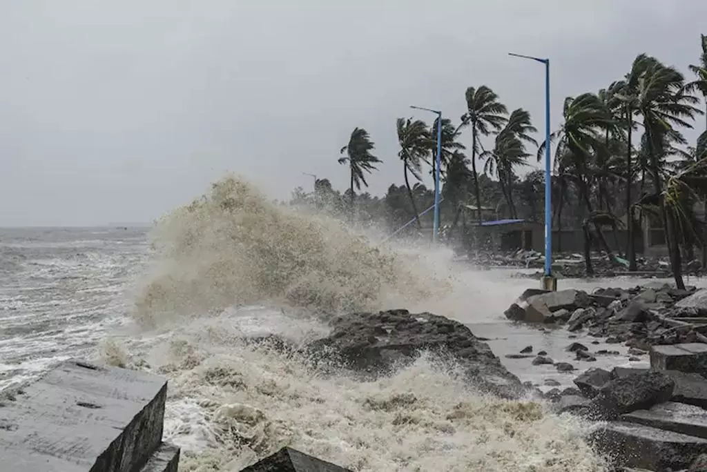
Strong winds and rough seas can make marine activities dangerous. Local authorities generally monitor ports, fishing activity, roads and vulnerable settlements when a deep depression approaches the coast.
The exact impact can also vary from district to district depending on the movement and strength of the system. Weather conditions may change quickly, so updated forecasts remain important.
No Cyclone Expected
According to the forecast, the system was not expected to intensify into a cyclonic storm. This means that the next cyclone name in the North Indian Ocean naming list would not be used for this system.
The name “Arnab” has already been designated for the next cyclonic storm in the region. Cyclones in the North Indian Ocean are named according to an established regional system involving countries around the basin.
Since the current system was expected to remain a deep depression, it would cross the coast without receiving the name Arnab.
Rainfall Impact Could Continue After Landfall
The effects of the Bay of Bengal Depression are not limited to the exact time of coastal crossing. Heavy rainfall can continue over inland districts as the system moves further into the land.
Areas of Andhra Pradesh, Odisha, Chhattisgarh and Telangana may therefore continue to experience significant rainfall during and after the system’s movement across the coast.
Authorities are watching for possible flooding, waterlogging, road disruptions and other weather-related problems. People are also advised to avoid unnecessary travel through areas affected by heavy rain and to follow official warnings.
The system highlights the importance of continuous weather monitoring along India’s eastern coastline during the monsoon season. The IMD and local administrations are tracking its movement and rainfall impact as it approaches the Andhra Pradesh-Odisha coast.