



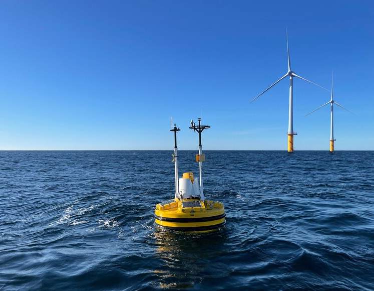
India Floating LiDAR Buoy Test Achieves Breakthrough

India Floating LiDAR Buoy Test has marked a major achievement in marine technology. The National Institute of Ocean Technology (NIOT) successfully tested this advanced system off the coast of Muttom. This innovation will improve ocean observation and help collect accurate atmospheric data in offshore areas.
Thank you for reading this post, don't forget to subscribe!What is Floating LiDAR Buoy System?
The Floating LiDAR Buoy System is a modern tool used to measure wind conditions over the sea. It combines a floating platform with LiDAR technology. The system uses laser pulses to collect detailed information about wind speed, direction, and changes at different heights above the ocean.
How the System Works
The system sends laser pulses into the air from a buoy placed on the sea surface. These pulses hit tiny particles in the air and return back to the sensor. By studying these signals, scientists can understand wind patterns and movement. The system can measure wind data up to 300 metres above sea level, giving more accurate and real-time results than traditional methods.

Key Features and Benefits
The Floating LiDAR Buoy System offers many advantages. It can work continuously in deep sea areas where fixed equipment cannot be installed. It provides high-precision data and helps in studying vertical wind patterns. This is very useful for offshore wind energy projects. The system also supports India’s goal of becoming self-reliant in advanced technologies by reducing dependence on foreign equipment.
India Floating LiDAR Buoy Test in Weather and Climate Studies
India Floating LiDAR Buoy Test will improve weather forecasting and cyclone tracking, especially in coastal regions. It will also help scientists study climate change and the relationship between the ocean and atmosphere. The system provides real-time data that can support disaster management and renewable energy planning.