




NASA ISRO NISAR Satellite 2025: A New Era in Earth Observation Begins

The NASA ISRO NISAR Satellite 2025 mission has reached a major milestone with the successful transmission of its first radar images of Earth’s surface. This achievement marks a pivotal step as the joint mission between the United States’ NASA and India’s ISRO prepares to commence full-scale scientific operations later in 2025. The high-resolution data gathered from this cutting-edge satellite will transform how scientists monitor natural disasters, track environmental changes, and manage global agricultural and infrastructure systems.
Thank you for reading this post, don't forget to subscribe!NASA ISRO NISAR Satellite 2025: Overview of the Mission
The NASA ISRO NISAR Satellite 2025 (NASA-ISRO Synthetic Aperture Radar) represents one of the most ambitious collaborations in Earth observation history. Officially launched on 30 July 2025, the satellite combines NASA’s advanced L-band Synthetic Aperture Radar (SAR) technology with ISRO’s S-band radar and proven satellite-building expertise.
Unlike optical imaging systems, NISAR’s radar sensors can capture images regardless of weather conditions or time of day. This allows for round-the-clock monitoring of Earth’s surface, even through dense clouds or thick vegetation.

The primary objective of NISAR is to map and measure changes in Earth’s land and ice surfaces with unprecedented detail. By collecting continuous radar data, scientists can observe the planet’s natural dynamics from glacier movements and deforestation to urban growth and coastal erosion.
NASA ISRO NISAR Satellite 2025: First Images and Their Global Significance
The first images released by the NASA ISRO NISAR Satellite 2025 mission highlight its remarkable imaging capabilities. These initial radar captures include regions such as Mount Desert Island in Maine and parts of northeastern North Dakota.
Each image reveals an intricate landscape showing forests, wetlands, water bodies, agricultural fields, and urban areas with astonishing clarity. With a spatial resolution that can distinguish objects as small as five meters, the NISAR satellite provides data that can revolutionize Earth system science.
These radar images are particularly valuable because they show surface structures and changes invisible to traditional optical satellites. Scientists can now observe land-use patterns, soil moisture levels, and vegetation density in real time. The implications for agriculture, disaster management, and environmental protection are profound.
Technological Powerhouse: Inside the L-Band and S-Band Radar Systems
At the heart of the NASA ISRO NISAR Satellite 2025 lies its dual-frequency radar system the L-band and S-band radars.
- The L-band radar, developed by NASA, can penetrate vegetation, snow, and even the top layers of soil. This enables the study of forest biomass, glacier thickness, and groundwater levels.
- The S-band radar, contributed by ISRO, provides complementary data with a shorter wavelength, useful for mapping finer surface features such as urban infrastructure and crop boundaries.
This combination allows scientists to build a comprehensive global map of how Earth’s land and ice systems evolve over time. The radar’s synthetic aperture technique creates high-resolution images by processing signals from multiple passes over the same area, ensuring accuracy in change detection.
NASA ISRO NISAR Satellite 2025: Applications in Environmental and Disaster Monitoring
The NISAR mission’s applications extend across numerous sectors. Its continuous and detailed radar imagery can revolutionize how the world monitors environmental processes.
- Forests and Biodiversity:
The satellite helps track forest loss and regeneration, assess carbon storage, and support climate change mitigation initiatives. - Agriculture:
By observing soil moisture and crop growth cycles, NISAR assists farmers and policymakers in making data-driven agricultural decisions, improving yield forecasts and water management. - Disaster Management:
The satellite’s ability to detect ground deformation enables early warnings for earthquakes, landslides, floods, and volcanic eruptions. Quick access to radar data can guide emergency response efforts and minimize loss of life and property. - Urban and Infrastructure Monitoring:
NISAR data aids in tracking urban expansion, monitoring dams and bridges, and planning sustainable infrastructure projects. - Polar and Ice Studies:
It measures the melting and shifting of glaciers, offering critical insights into sea-level rise and the effects of global warming.
The mission’s data will be freely available to the global scientific community, ensuring that nations worldwide benefit from its findings.
NASA ISRO NISAR Satellite 2025: A Model of International Collaboration
The NASA ISRO NISAR Satellite 2025 stands as a shining example of international cooperation in science and technology. By combining NASA’s radar expertise and ISRO’s cost-effective satellite and launch capabilities, both agencies have created one of the most advanced Earth-observation systems ever built.
This collaboration demonstrates the shared commitment of the United States and India to address global challenges such as climate change, disaster resilience, and sustainable resource management.
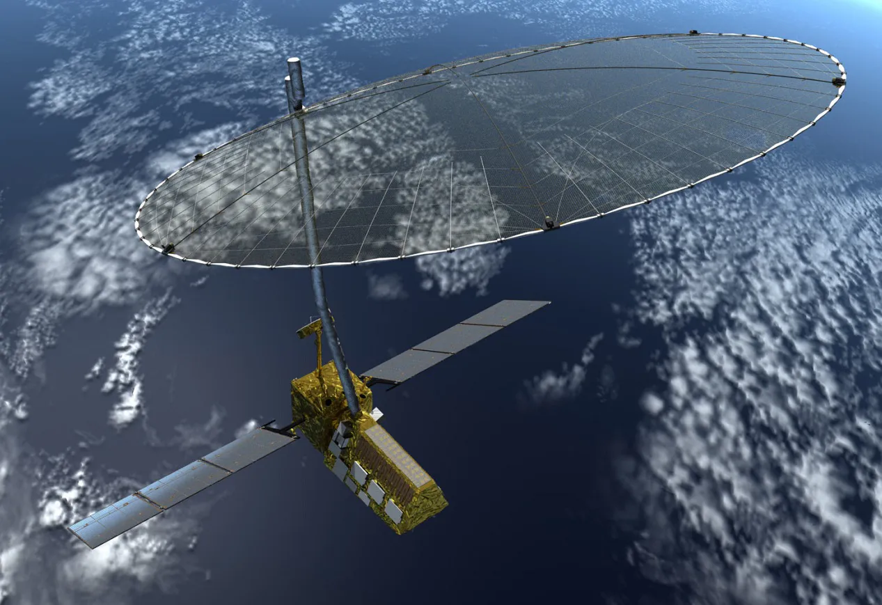
The NISAR project also sets a precedent for future missions beyond Earth. Lessons learned from radar imaging and surface mapping will contribute to planetary science supporting missions to the Moon, Mars, and icy moons like Europa.
ISRO’s successful launch of NISAR aboard its GSLV Mk III rocket and NASA’s expertise in radar instrumentation have opened a new chapter in space-based Earth observation. The mission will operate for at least three years, with potential extensions depending on its technical performance and scientific output.
Future Outlook for NASA ISRO NISAR Satellite 2025 Mission
As the NASA ISRO NISAR Satellite 2025 moves toward full scientific operations, expectations are high. The mission’s continuous global data stream will fuel research in climate modeling, agriculture management, and environmental forecasting.
Researchers worldwide are preparing to integrate NISAR’s radar data with AI and machine learning tools to detect trends and anomalies faster than ever before. This combination of space science and artificial intelligence could revolutionize environmental policymaking and resource management at both national and international levels.
By bridging scientific innovation and global cooperation, NASA ISRO NISAR Satellite 2025 is not just a technological achievement it’s a symbol of how humanity can work together to understand and protect our changing planet.