


Dhemaji District: History, Geography, Culture, Economy and Tourist Places

Introduction
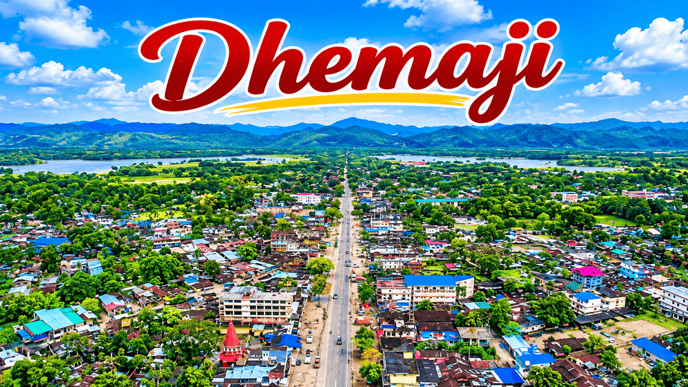
Dhemaji District is one of the important districts of Assam, located in the northeastern part of the state. Known for its beautiful natural surroundings, flowing rivers, green agricultural fields and diverse cultural traditions, Dhemaji represents an important part of Assam’s geographical and cultural identity. The district lies near the foothills of Arunachal Pradesh and is characterised by the Brahmaputra River system, fertile plains and numerous tributaries.
Dhemaji is particularly known for its agricultural activities, indigenous communities, traditional festivals and historical sites. Rice cultivation is an important occupation, while livestock farming, fishing, handloom and sericulture also contribute to the local economy. The district experiences heavy rainfall during the monsoon season, making floods and riverbank erosion major challenges for many communities.

Established as a separate district on 14 October 1989, Dhemaji has developed into an important administrative and cultural region of Upper Assam. Its archaeological remains, religious places, wildlife habitats and scenic locations make it an interesting destination for people who want to explore the history and natural beauty of Assam.
History of Dhemaji District
The history of Dhemaji is closely connected with the ancient kingdoms of Assam, particularly the Ahom and Chutia kingdoms. The region has been home to several indigenous communities for centuries and has played a role in the political and cultural development of the Brahmaputra Valley.
According to the Dhemaji District Administration, the Ahom ruler Sukaphaa is believed to have established an early capital at Habung around 1240 AD. However, frequent flooding in the region created difficulties, and the capital was later shifted.
The area subsequently came under the influence of the Chutia kingdom, which ruled parts of the region until the early sixteenth century. Around 1523, the Ahoms defeated the Chutia ruler Nityapal, bringing the territory under Ahom control.
Before becoming an independent district, Dhemaji was part of the larger Lakhimpur administrative region. It received sub-divisional status in 1971 and was officially recognised as a separate district in 1989. The district was formed with Dhemaji and Jonai as its principal administrative subdivisions.
Origin of the Name Dhemaji
There is a popular local explanation regarding the origin of the name Dhemaji. According to this account, the area experienced frequent floods because of rivers that repeatedly changed their courses.
The Assamese words Dhal, meaning flood, and Dhemali, meaning play, are associated with the expression Dhal-Dhemali, often interpreted as a place where floods play. Over time, the expression is believed to have developed into the name Dhemaji.
This explanation reflects the district’s long relationship with its rivers and recurring floods. The account is recorded on the official district administration’s history page.
Geographical Location and Area
Dhemaji is situated in the northeastern part of Assam, within the Upper Assam region. It occupies an important geographical position between the Brahmaputra Valley and the foothills of Arunachal Pradesh.
The district covers approximately 3,237 square kilometres and has a landscape consisting mainly of plains, foothill areas, alluvial land and river valleys. The northern part gradually rises towards the Himalayan foothills, while the southern region contains extensive low-lying floodplains.
The district is surrounded by Arunachal Pradesh towards the north, while the Brahmaputra River forms an important geographical feature along its southern side. Lakhimpur lies towards the western side. Its eastern geographical surroundings connect with the river valleys and adjoining areas towards Arunachal Pradesh and Upper Assam.
The geographical position of Dhemaji makes it an important region for understanding the river systems of northeastern India. Rivers originating in the hills of Arunachal Pradesh flow southwards through the district before joining larger river systems.
According to the Central Ground Water Board, Dhemaji has a combination of piedmont deposits, older alluvial formations and newer floodplain deposits. These geographical features influence agriculture, groundwater availability and settlement patterns.
Rivers of Dhemaji District
Rivers are among the most important geographical features of Dhemaji. The district has an extensive network of rivers and smaller streams that originate mainly in the neighbouring hills of Arunachal Pradesh.
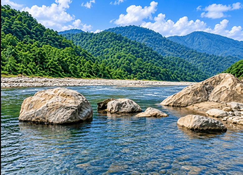
The Brahmaputra flows along the southern side of the district and influences its drainage system. Several tributaries flow through the district, carrying water and sediments from the Himalayan foothills.
Some important rivers and tributaries associated with Dhemaji include:
- Subansiri River: One of the largest tributaries of the Brahmaputra, flowing along the western part of the district.
- Jiadhal River: Originating in Arunachal Pradesh, it enters the plains of Dhemaji and is known for its heavy sediment load and flood-related changes.
- Gainadi River: An important tributary that contributes to the district’s drainage network.
- Moridhal River: One of the rivers associated with the agricultural and floodplain areas of Dhemaji.
- Simen River: Flows through the northern and central parts of the district.
- Dihingia River: Another river associated with the district’s extensive water network.
- Tangani River: Contributes to the drainage system of the region.
These rivers support agriculture, fishing and other local activities. However, their high water levels during the monsoon often cause floods, erosion and damage to agricultural land.
The Jiadhal River is particularly known for carrying large amounts of silt from its upper catchment. The accumulation of sediments can change river channels and increase flood risks in nearby settlements.
The Assam Water Resources Department and the Assam State Disaster Management Authority provide information about the district’s river network and flood-related challenges.
Climate and Weather
Dhemaji experiences a humid subtropical climate with considerable rainfall throughout the year. Summers are generally warm, while winters are comparatively mild and cool.
The monsoon season usually begins around April or May and continues through September. July is generally one of the wettest months. Annual rainfall varies across the district, with government reports recording approximately 2,600–3,200 mm in some assessments.
Temperatures can vary considerably between seasons. The district’s northern foothill areas and southern plains may also experience different local weather conditions.
Heavy monsoon rainfall, combined with water flowing down from the Arunachal Pradesh hills, makes Dhemaji particularly vulnerable to flooding. Riverbank erosion is another major environmental concern.
Floods can affect roads, houses, agricultural fields and communication facilities. Embankments, drainage improvements and flood-management projects are therefore important for the district’s development.
Population and Demography of Dhemaji
Dhemaji has a predominantly rural population. Agriculture and village-based activities remain important parts of everyday life.
The demographic figures below are based on the 2011 Census data provided in the District Irrigation Plan and Census of India publications. They should not be interpreted as current population estimates.
| Population indicator | Census 2011 |
|---|---|
| Total population | 6,86,133 |
| Male population | 3,51,249 |
| Female population | 3,34,884 |
| Sex ratio | 953 females per 1,000 males |
| Rural population | 6,37,848 |
| Urban population | 48,285 |
| Child population (0–6 years) | 1,04,247 |
| Child sex ratio | 950 |
| Literacy rate | 72.70% |
| Male literacy | 79.84% |
| Female literacy | 65.21% |
| Scheduled Caste population | 6.45% |
| Scheduled Tribe population | 47.45% |
The figures show that nearly 93% of the population lived in rural areas in 2011. The district also had a substantial Scheduled Tribe population, reflecting its diverse indigenous communities.
The population includes communities such as the Mising, Sonowal Kachari, Deori, Bodo Kachari and others. Assamese and various indigenous languages are part of the region’s cultural and linguistic diversity.
The population and literacy figures are sourced from the Census 2011 material and Assam government district documents.
Culture and Indigenous Communities
Dhemaji is known for its diverse cultural traditions and indigenous heritage. Several communities have contributed to the district’s traditional lifestyle, festivals, food, music, dance and handicrafts.
The Mising community is one of the major indigenous communities of Dhemaji. Their traditional houses, handloom products, agricultural practices and festivals form an important part of the region’s cultural identity.
Bihu is widely celebrated in the district, particularly Rongali Bihu, which marks the Assamese New Year and the arrival of spring. Traditional music, dance and community gatherings are important parts of the celebration.
The Mising community also celebrates Ali-Aye-Ligang, an agricultural festival associated with the beginning of the sowing season. Traditional songs, dances and community feasts are important features of this festival.
Other communities, including the Sonowal Kachari, Deori, Bodo Kachari and Ahom communities, also contribute to the cultural diversity of the district.
Traditional handloom weaving is an important household activity. Mising women are particularly known for weaving colourful textiles with traditional designs. Muga and Eri silk production also forms part of the wider traditional textile economy of the region.
Economy and Agriculture
Agriculture is the backbone of the economy of Dhemaji. The district’s fertile alluvial soil, river systems and rainfall provide favourable conditions for growing different agricultural crops.
Paddy is the principal crop and is cultivated across large parts of the district. Rice is also the main food crop of the local population.
Other important agricultural products include:
- Mustard and other oilseeds
- Potato
- Pulses
- Vegetables
- Seasonal fruits
- Different horticultural crops
Many farmers depend on seasonal rainfall for cultivation. However, recurring floods sometimes destroy crops, damage agricultural land and affect household income.
Livestock Farming and Allied Activities
Livestock farming provides additional income for rural households. Cattle rearing, dairy farming, piggery, poultry and goat farming are practised in different parts of the district.
Fishing is another important activity because of the presence of rivers, wetlands and other water bodies. Local fish production supports household consumption as well as small-scale markets.
Sericulture and Handloom
Sericulture is an important traditional economic activity in Assam, and Dhemaji is associated with the production of Muga and Eri silk.
Muga silk is particularly famous in Assam for its natural golden colour, while Eri silk is valued for its soft texture and traditional use.
Handloom weaving also provides employment, particularly among women in rural communities. Traditional fabrics and indigenous designs represent both cultural heritage and economic activity.
Government agriculture and development reports identify paddy cultivation, livestock and other allied activities as important parts of the district’s economy.
Administrative Structure of Dhemaji
Dhemaji district is administered through its district headquarters at Dhemaji town. Jonai is another important administrative centre in the district.
The district administration manages public services, revenue administration, rural development, education, healthcare, disaster management and other government activities.
According to the district administration’s published profile, the administrative structure includes four revenue circles and five principal development blocks.
The development blocks listed in the district profile are:
- Dhemaji
- Sissiborgaon
- Bordoloni
- Machkhowa
- Murkongselek (Murkongselek Tribal Development Block)
The district also has a network of revenue villages and Gaon Panchayats. The official district profile records approximately 1,150 revenue villages and 65 Gaon Panchayats.
Dhemaji and Jonai are the two principal subdivisions traditionally associated with the district’s administrative structure. The current district profile also identifies Jonai as a co-district.
These administrative institutions play an important role in delivering government services to rural and urban communities.
Tourist Places in Dhemaji District
Dhemaji offers a combination of natural landscapes, religious sites, historical associations and wildlife habitats. Its rivers, green surroundings and cultural heritage attract visitors interested in exploring Upper Assam.
Some notable places associated with the district and its surrounding region are described below.
Gerukamukh
Gerukamukh is a scenic destination near the Assam–Arunachal Pradesh border. It is associated with the Subansiri River, one of the major tributaries of the Brahmaputra.
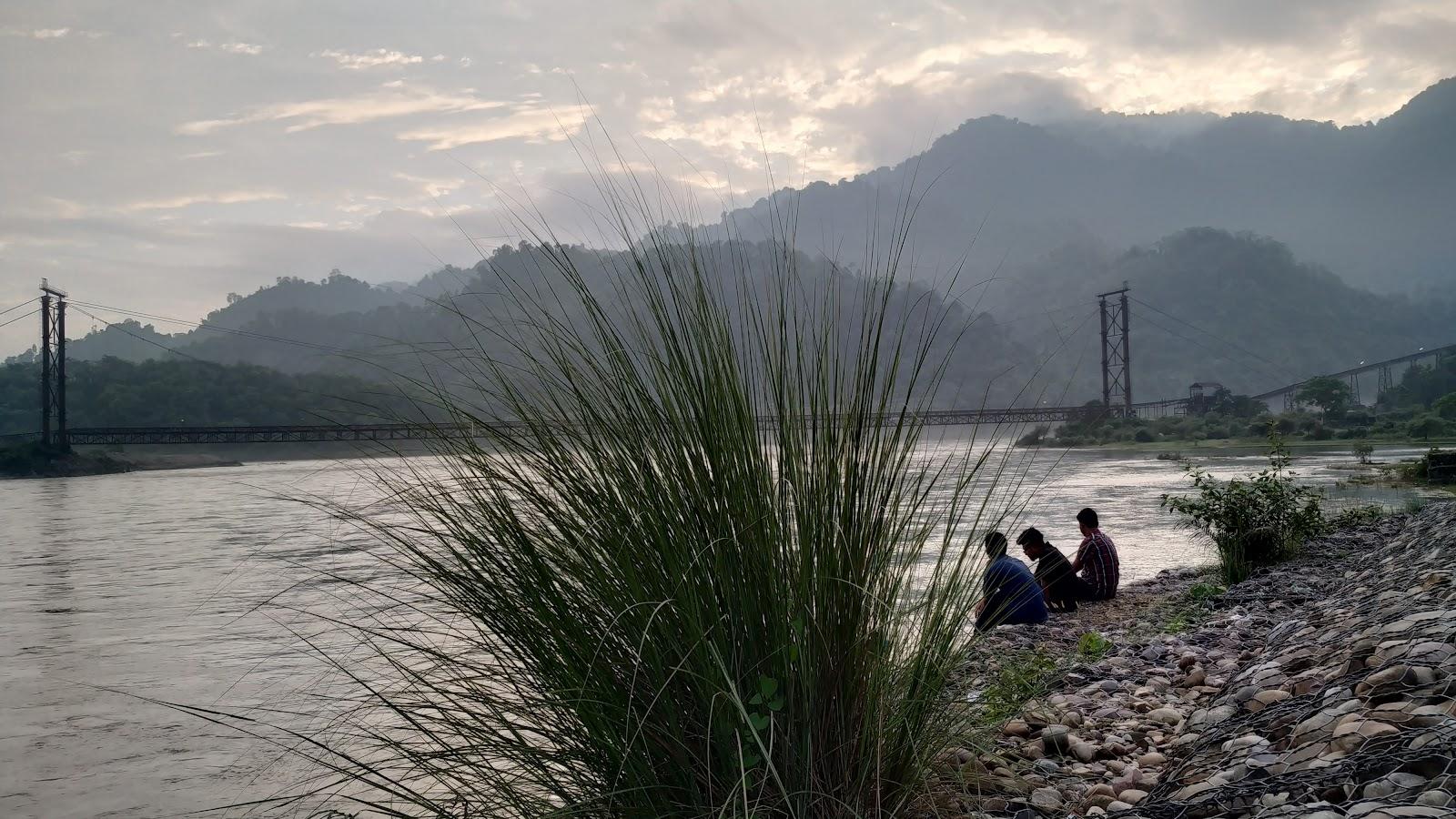
The area is surrounded by hills, greenery and river landscapes. Its natural surroundings make it a popular location for sightseeing and picnics.
Gerukamukh is also known because of the Lower Subansiri Hydroelectric Project, constructed on the Subansiri River. The project has brought considerable attention to the area because of its importance for hydroelectric power generation and discussions about river management and downstream impacts.
Visitors should check local access conditions before travelling, particularly during the monsoon season.
Maa Manipuri Than
Maa Manipuri Than is a religious site associated with the historical relationship between the Ahom kingdom and the Manipuri community.
According to local historical tradition, the temple was established during the reign of Ahom King Swargadeo Gaurinath Singha. It is associated with the Manipuris who provided assistance to the Ahom kingdom during a difficult period.
The site is an important part of the district’s religious and cultural heritage. Devotees visit the temple to offer prayers and participate in religious activities.
Ghuguha Dol
Ghuguha Dol is another religious and historical site associated with Dhemaji’s Ahom-era traditions.
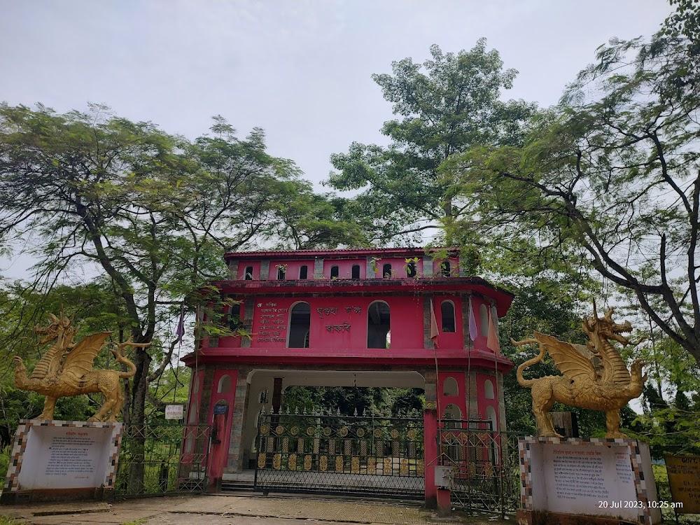
Local legends connect this place with Bamuni Konwar, who is traditionally believed to have been born at the site. The story gives the temple cultural importance among local people.
Like several historical religious structures in Assam, Ghuguha Dol represents the connection between local traditions, Ahom history and religious practices.
Bardoibam-Beelmukh Bird Sanctuary
Bordoibam-Beelmukh Bird Sanctuary is an important wetland habitat situated across the Dhemaji and Lakhimpur districts.
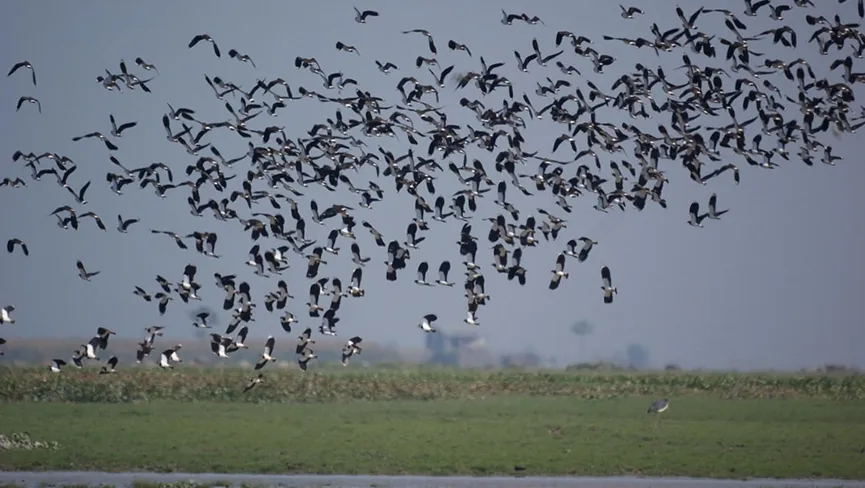
The sanctuary covers approximately 11.25 square kilometres and is recognised for its importance to birdlife. It provides habitat for several resident and migratory bird species.
Birds recorded in the area include:
- Large Whistling Teal
- Kingfishers
- Lesser Adjutant Stork
- Pheasant-tailed Jacana
- Bronze-winged Jacana
- Purple Moorhen
- Openbill Stork
The wetland ecosystem also supports different aquatic species, including indigenous fish, frogs and snakes.
The Assam Forest Department identifies the area as a bird sanctuary and notes its importance as a breeding ground for the Large Whistling Teal. Its conservation is important for protecting wetland biodiversity in Upper Assam.
Malinithan
Malinithan is an important archaeological and religious site in the neighbouring state of Arunachal Pradesh. It is situated near Likabali in the West Siang region, close to the Assam border.
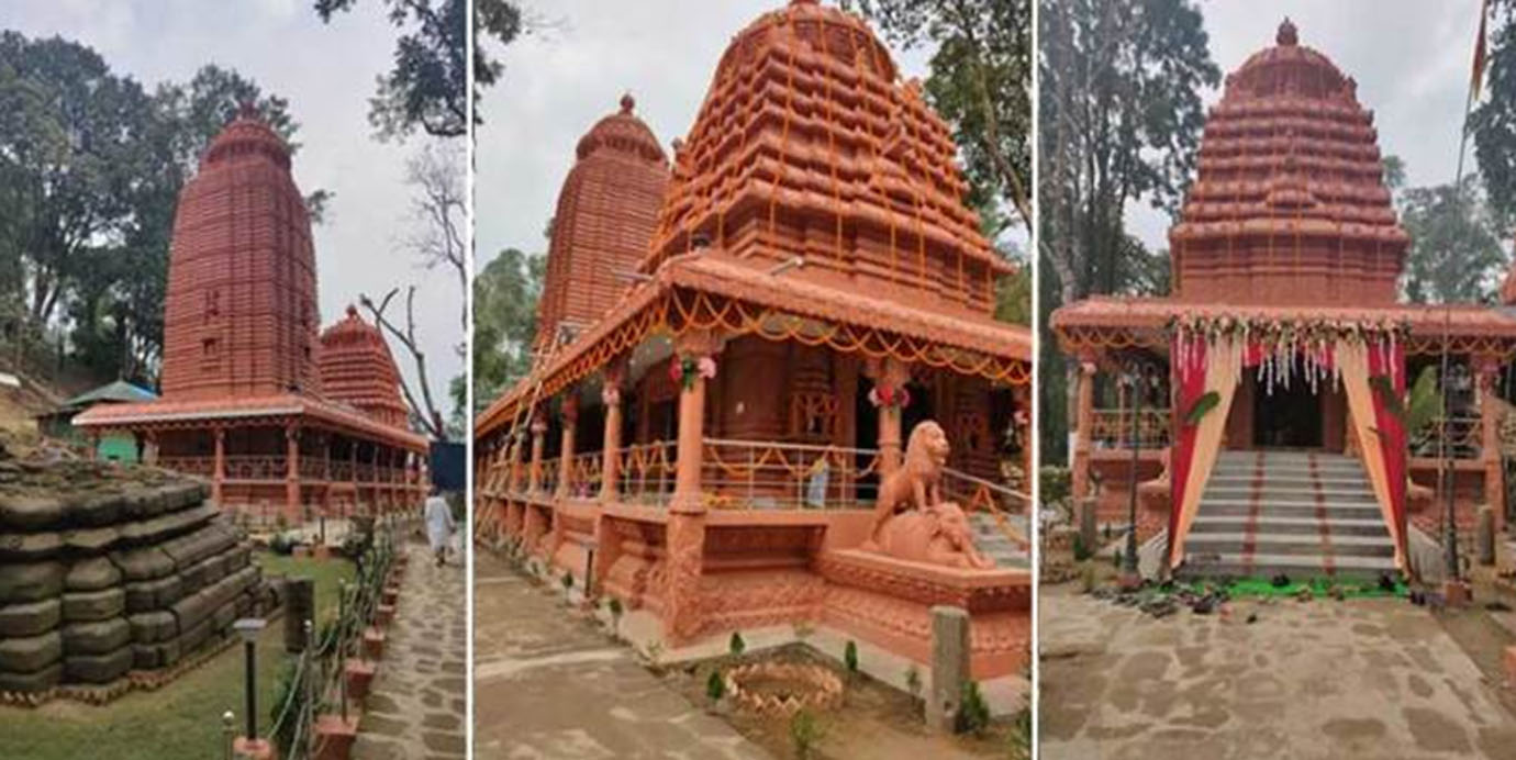
The site contains the remains of ancient temple structures, stone sculptures and architectural fragments. Archaeological remains indicate that the temple complex belongs broadly to the period between the tenth and fourteenth centuries.
Malinithan is associated with legends involving Lord Krishna, Rukmini and Goddess Parvati. It is also an important destination for people interested in the history and archaeology of the northeastern region.
Geographical clarification: Malinithan is not located within Dhemaji district. It is included here as a nearby regional attraction that visitors exploring the Dhemaji–Likabali area may also consider. The Arunachal Pradesh government’s Department of Cultural Affairs identifies it as a protected archaeological monument in West Siang.
Transport and Connectivity
Dhemaji is connected to other parts of Assam and neighbouring Arunachal Pradesh through roadways, railways and waterways.
Road Connectivity
Road transport is an important means of communication in the district. National Highway 15 connects Dhemaji with important towns and other parts of Upper Assam. The road network also connects rural villages, agricultural areas and markets.
The Bogibeel Bridge over the Brahmaputra has improved connectivity between Dhemaji and Dibrugarh. It provides an important road and railway connection between the north and south banks of the Brahmaputra.
Railway Connectivity
Dhemaji has its own railway station, which connects the district with other railway stations in Assam. Silapathar and Murkongselek are also important railway stations serving the district and nearby areas.
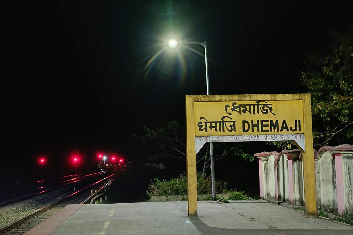
These railway connections are useful for passenger movement and transportation of goods.
Air Connectivity
Dhemaji does not have a major commercial airport within the district. Lilabari Airport near North Lakhimpur and Dibrugarh Airport are the nearest important airport options.
Waterways
The Brahmaputra River and its connected waterways have traditionally played a role in transportation and communication. Ferry services connect different riverbank locations, including routes linking Dhemaji with areas around Dibrugarh.
The Krishi Vigyan Kendra, Dhemaji, provides information about the district’s road, railway, airport and ferry connectivity.
Education and Development
Education is an important part of Dhemaji’s social development. Schools, colleges and other educational institutions serve students from different parts of the district.
The expansion of educational facilities has improved access to learning for rural communities. However, some remote areas continue to face challenges related to transportation, infrastructure and access to educational resources, particularly during floods.
Agricultural development, rural roads, healthcare facilities, electricity, drinking water and digital connectivity are also important areas of development.
The district’s location near Arunachal Pradesh gives it additional importance for regional trade, transportation and cross-border economic activities.
Major Challenges Facing Dhemaji
Despite its natural resources and agricultural potential, Dhemaji faces several geographical and developmental challenges.
Floods and riverbank erosion: Annual monsoon floods affect villages, agricultural fields, roads and other infrastructure. Riverbank erosion can also force families to relocate.
Agricultural losses: Farmers depend heavily on seasonal rainfall. Excessive rainfall and flooding can damage paddy fields and other crops.
Connectivity difficulties: During severe floods, roads and communication networks may become disrupted, affecting transportation and access to essential services.
Employment opportunities: Agriculture remains an important source of livelihood. Expanding small industries, local businesses, food processing and other employment opportunities can help diversify the district’s economy.
Environmental conservation: Wetlands, river ecosystems and bird habitats require protection from pollution, habitat loss and other environmental pressures.
Addressing these challenges is important for improving the living conditions of local communities and supporting sustainable development.
Importance of Dhemaji in Assam
Dhemaji holds an important place in Assam because of its geographical position, indigenous heritage, agricultural activities and natural resources.
The district represents the close relationship between the Brahmaputra River system and the communities living along its banks. Its fertile plains support agriculture, while its wetlands and rivers provide habitats for different forms of wildlife.
Its historical connections with the Ahom and Chutia kingdoms also make it an interesting region for understanding Assam’s past.
The district’s cultural diversity, traditional weaving, festivals and religious sites further contribute to the identity of Upper Assam.
Conclusion
Dhemaji is much more than a district known for its rivers and floods. It is a region with a rich history, diverse indigenous communities, agricultural importance and beautiful natural surroundings. From the historical traditions of Habung to the scenic river landscapes of Gerukamukh, the district offers a glimpse into the geographical and cultural richness of Assam.
Although floods, erosion and infrastructure challenges continue to affect the region, its agricultural resources, cultural heritage and improving connectivity provide opportunities for future development. Protecting its natural environment and supporting local communities will remain important for the long-term progress of Dhemaji.
Frequently Asked Questions (FAQs) About Dhemaji District
Where is Dhemaji District located?
Dhemaji District is located in northeastern Assam, India. It lies near the foothills of Arunachal Pradesh and forms part of the Upper Assam region.
When was Dhemaji District established?
Dhemaji became a separate district on 14 October 1989. Before that, it was part of the larger Lakhimpur administrative region.
What is the headquarters of Dhemaji District?
Dhemaji town is the district headquarters and an important administrative centre.
What is the total area of Dhemaji District?
Dhemaji covers approximately 3,237 square kilometres.
Which river is important in Dhemaji District?
The Brahmaputra is the major river along the southern side of the district. Other important rivers include the Subansiri, Jiadhal, Gainadi, Moridhal and Simen.
Why is Dhemaji known as a flood-prone district?
Dhemaji receives heavy monsoon rainfall and has several rivers flowing from the hills of Arunachal Pradesh. These rivers often overflow during the rainy season, causing floods and riverbank erosion.
What are the main occupations of people in Dhemaji?
Agriculture is the principal occupation. Paddy cultivation, mustard farming, livestock rearing, fishing, sericulture and handloom weaving are also important economic activities.
Which communities live in Dhemaji District?
The district is home to several indigenous communities, including the Mising, Sonowal Kachari, Deori, Bodo Kachari and Ahom communities.