



Dima Hasao: Hills, Tribes and Tourist Attractions of Assam

Introduction
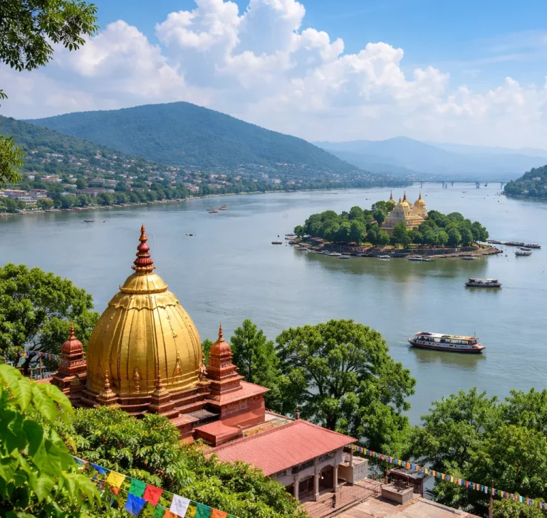
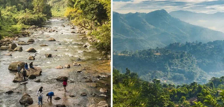
Dima Hasao is one of the most beautiful and culturally diverse districts of Assam. Located in the southern part of the state, this picturesque hill district is famous for its green mountains, mist-covered valleys, waterfalls, rivers, forests and traditional tribal communities. Often called the Switzerland of the Northeast, Dima Hasao attracts visitors who want to experience the natural beauty and cultural heritage of Assam.
Formerly known as North Cachar Hills, the district is home to several indigenous communities, including the Dimasa, Zeme Naga, Hmar, Kuki, Biate, Karbi and Hrangkhol. Each community has its own traditions, languages, festivals, food habits and cultural practices.

The district headquarters, Haflong, is widely known as the only hill station in Assam. Other popular destinations include Jatinga, Umrangso, Maibang and Panimur Waterfall. From ancient historical remains to peaceful lakes and mountain viewpoints, Dima Hasao offers a combination of nature, history and cultural experiences.
Geographical Location and Physical Features
Dima Hasao is one of the three hill districts of Assam. The Borail Range is its most important geographical feature. The district is surrounded by Karbi Anglong, West Karbi Anglong and Hojai in the north, Cachar in the south, Nagaland and Manipur in the east, and Meghalaya in the west.
The district covers approximately 4,888 square kilometres, making it the third-largest district in Assam by geographical area according to the District Census Handbook. Its landscape includes high hills, green valleys, forests, rivers and rocky slopes.
Thumjang Peak, standing at approximately 1,866 metres above sea level, is the highest peak in the district. Hempeupet, at around 1,748 metres, is another important mountain peak. The Borail Range forms the backbone of the district’s hilly landscape. asdma.assam.
Several rivers flow through Dima Hasao, including the Kopili, Diyung, Mahur, Jatinga, Langting and Dhansiri. These rivers support local communities, agriculture and the natural ecosystems of the region.
The district experiences a relatively pleasant climate compared with the hot plains of Assam. Haflong and its surrounding hills are particularly popular among visitors looking for cool weather, mountain views and peaceful natural surroundings.
History of Dima Hasao
The history of Dima Hasao is closely connected with the ancient Dimasa Kachari Kingdom. The region was historically inhabited by the Dimasa Kacharis and several other indigenous communities, including the Zeme Nagas, Hmars, Kukis, Biates and Hrangkhols.
The Ancient Cachari Kingdom
The Dimasa Kacharis played an important role in the history of the region. According to the District Census Handbook, historical records indicate that the Kachari royal establishment shifted from Dimapur to Maibong around 1563 AD.
Maibong subsequently became an important capital of the Kachari Kingdom. The kingdom developed its political and cultural influence in the surrounding hill areas. Historical remains, stone structures and archaeological features in Maibong provide evidence of this royal past.
The British Colonial Period
During British rule, the North Cachar Hills region was administered under special arrangements. Along with the neighbouring hill areas, it was classified as a partially excluded area. This system provided a distinct administrative framework for tribal regions, where the application of general laws could be restricted or modified.
These arrangements reflected the importance of protecting the customs, traditional practices and land rights of indigenous communities.
Formation of the Autonomous Council
After India’s independence, tribal representatives sought a separate administrative arrangement to protect their cultural identity and traditional rights.
The United Mikir and North Cachar Hills District was established in 1951 with autonomous councils. The North Cachar Hills District Council was subsequently established under the Sixth Schedule of the Indian Constitution in 1952.
On 2 February 1970, North Cachar Hills became a separate district, with Haflong as its headquarters.
In 2010, the district was officially renamed Dima Hasao, meaning Dimasa Hills. The name reflects the historical and cultural connection of the region with the Dimasa community. The autonomous council continues to retain the name North Cachar Hills Autonomous Council in its official nomenclature.
Tribes and Cultural Diversity of Dima Hasao
One of the most remarkable features of Dima Hasao is its cultural diversity. Several indigenous communities live together in the district, preserving their traditional languages, customs, festivals, music, dance forms, clothing and handicrafts.
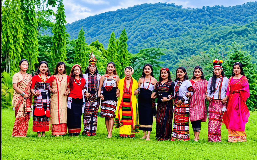
The major tribal communities include:
- Dimasa: One of the major indigenous communities of the district, with a deep historical connection to the Kachari Kingdom. Their traditional dances, music and festivals are important parts of the local cultural identity.
- Zeme Naga: A Naga community known for its distinctive cultural practices, traditional festivals and village-based social life.
- Hmar: The Hmar community has a rich tradition of music, dance, weaving and community celebrations.
- Kuki: The Kuki people have their own traditional customs, festivals, languages and cultural practices.
- Biate: The Biate community is known for its traditional clothing, weaving and cultural heritage.
- Hrangkhol: Another indigenous community that contributes to the district’s diverse cultural landscape.
- Karbi: The Karbi community has its own language, traditional festivals and distinctive cultural practices.
Other communities, including Khelma and Vaiphei, also contribute to the district’s ethnic diversity.
Traditional festivals are an important part of community life. The Dimasa people celebrate Bushu Dima, a major harvest festival that brings communities together through traditional music, dance, food and celebrations.
Traditional weaving is another important cultural practice. Colourful garments, handmade textiles, bamboo products and other handicrafts reflect the creativity and skills of local communities.
The district’s cultural richness makes it an interesting destination for visitors who want to understand the indigenous heritage of Northeast India.
Socio-Economic Life of Dima Hasao
Agriculture is an important source of livelihood for many people in Dima Hasao. The district’s hilly terrain and rural settlements support different farming practices.
Rice is one of the major crops cultivated in the region. Ginger, turmeric, vegetables and various seasonal fruits are also grown by local farmers.
Traditional agricultural practices, including shifting cultivation in some areas and terrace farming where suitable, are part of the rural economy. Bamboo, forest resources and traditional handicrafts also contribute to local livelihoods.
Tourism is another sector with potential for economic development. The district’s waterfalls, hills, lakes, historical sites and indigenous cultures create opportunities for eco-tourism, nature tourism and adventure activities.
Local food, traditional markets, handicrafts and community festivals also offer visitors an opportunity to experience everyday life in the hill district.
Population and Demographic Features
According to the 2011 Census of India, Dima Hasao had a total population of 214,102 people. The district has a predominantly rural population and a large Scheduled Tribe population.
The following table presents important demographic information from Census 2011.
| Demographic indicator | Census 2011 data |
|---|---|
| Total population | 214,102 |
| Male population | 110,802 |
| Female population | 103,300 |
| Sex ratio | 932 females per 1,000 males |
| Literacy rate | 77.54% |
| Male literacy rate | 83.29% |
| Female literacy rate | 71.33% |
| Population density | 44 persons per sq. km |
| Scheduled Tribe population | 151,843 |
| Scheduled Caste population | 4,337 |
| Rural population | 151,613 |
| Urban population | 62,489 |
The Scheduled Tribe population accounts for approximately 70.9% of the district’s total population. This makes Dima Hasao an important tribal-majority district of Assam.
The figures above are historical Census 2011 statistics, not current population estimates.
Administrative Structure of Dima Hasao
Dima Hasao has a special administrative arrangement under the Sixth Schedule of the Indian Constitution. The district is administered through the state government and the North Cachar Hills Autonomous Council (NCHAC).
The autonomous council has legislative and executive powers over several subjects, including local development, land-related matters, customary practices and village administration, as provided under the Sixth Schedule.
The council has 28 elected members representing autonomous council constituencies, along with its administrative structure. Its headquarters and secretariat are located in Haflong.
The Deputy Commissioner also plays an important role in district administration, including general administration, revenue matters, law and order and coordination of government activities.
Major Tourist Attractions in Dima Hasao
Dima Hasao is known for its natural beauty, historical places and peaceful hill destinations. Its tourist attractions include mountain viewpoints, waterfalls, lakes, traditional villages and ancient archaeological remains.
Haflong – The Only Hill Station of Assam
Haflong is the headquarters of Dima Hasao and is widely recognised as the only hill station in Assam. Located among green hills and valleys, it is a popular destination for visitors seeking a peaceful mountain holiday.
Haflong is often called the Scotland of Assam because of its beautiful landscape and pleasant surroundings.
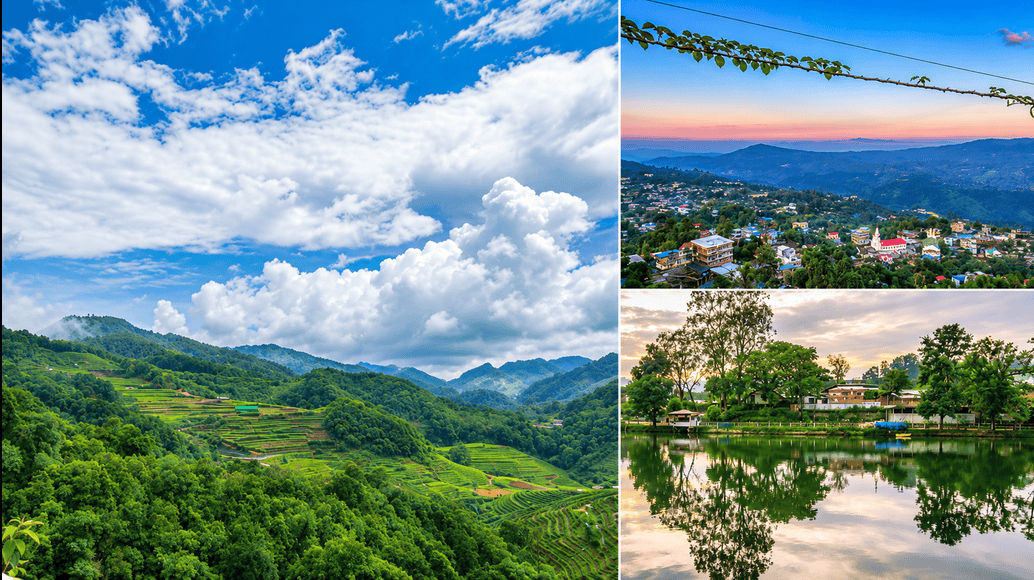
The town offers scenic views of the surrounding mountains, winding roads, green slopes and traditional settlements. Visitors can explore local markets, enjoy the cool atmosphere and experience the cultural diversity of the district.
Haflong Lake
Haflong Lake is one of the most popular attractions in the district headquarters. Situated in the heart of Haflong town, this lake provides a peaceful setting for visitors.
It is a suitable place for spending time with family and friends, enjoying the surrounding scenery and taking photographs. Boating and other recreational activities may be available depending on local arrangements.
The lake is particularly attractive during the pleasant months when the surrounding greenery creates a beautiful natural setting.
Jatinga – The Mysterious Bird Phenomenon
Jatinga is one of the most internationally recognised places in Dima Hasao. It is famous for a seasonal bird-disorientation phenomenon that has attracted the attention of researchers and bird enthusiasts.
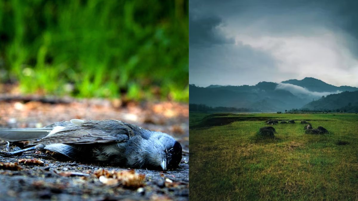
During particular periods, especially in the monsoon and post-monsoon season, certain birds become disoriented under specific weather and low-visibility conditions. Some birds may fly towards artificial lights and collide with nearby structures.
This unusual behaviour was popularly described as the mysterious suicide of birds. However, birds do not deliberately commit suicide. The phenomenon is associated with environmental conditions, visibility and light attraction.
Jatinga is also known for its beautiful hills, scenic surroundings and opportunities to learn about local birdlife.
Visitors interested in nature and birdwatching can explore the village and its surrounding viewpoints.
Umrangso – A Beautiful Hill Town
Umrangso is a picturesque town in Dima Hasao, surrounded by hills, forests and water bodies. It is known for the Kopili Hydro Electric Project and the scenic reservoir landscape.
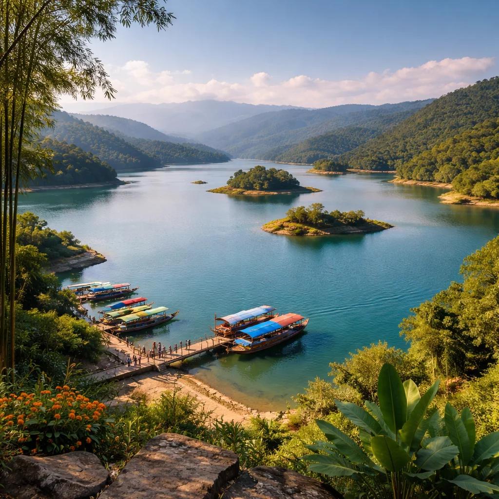
The town is an interesting destination for people who enjoy nature, photography and outdoor activities. The surrounding hills and water bodies create opportunities for sightseeing and exploring the natural environment.
The Umrangso area is also associated with adventure tourism, including trekking and other outdoor experiences, depending on local facilities and conditions.
Panimur Waterfall – The Niagara of Northeast India
Panimur Waterfall is one of the most beautiful natural attractions in Dima Hasao. Located on the Kopili River, the waterfall is known for its rocky riverbed, flowing water and scenic surroundings.
It is sometimes called the Niagara of Northeast India because of its impressive appearance.
The river flows through rocky formations, creating beautiful cascades and rapids. The area attracts visitors who enjoy photography, picnics and nature trips.
During the rainy season, the water flow can become stronger, making the area potentially dangerous. Visitors should follow local safety instructions and avoid entering fast-flowing water.
Maibong – The Ancient Capital of the Dimasa Kingdom
Maibong is an important historical destination in Dima Hasao. It was once the capital of the Dimasa Kachari Kingdom and has considerable historical and archaeological importance.
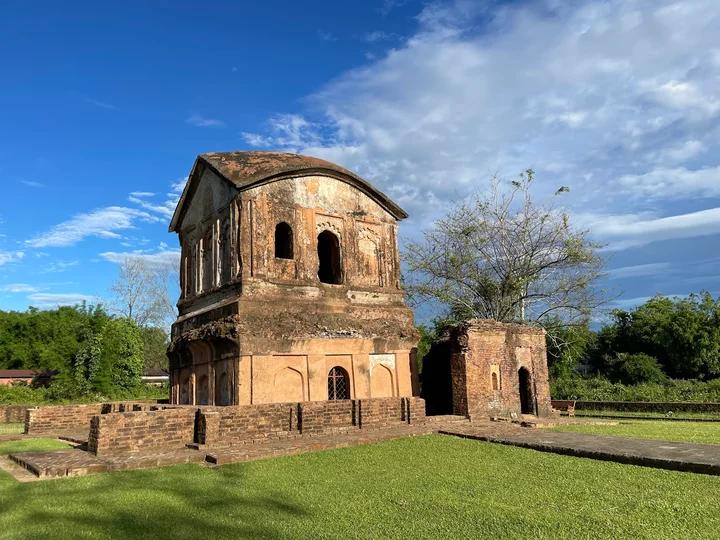
The town is situated near the Mahur River and contains remains associated with the ancient Kachari rulers.
The most notable historical attractions include stone structures, sculptures and other archaeological remains. These monuments provide information about the architectural and cultural traditions of the Dimasa Kingdom.
For history lovers, Maibong offers an opportunity to explore an important chapter of Assam’s past.
Hajong Lake
Hajong Lake, also known as Hajong Tortoise Lake, is another interesting natural attraction in Dima Hasao.
The lake is associated with freshwater turtles and provides a peaceful environment surrounded by greenery. It is a suitable destination for nature lovers and people interested in local biodiversity.
The surrounding landscape makes it a pleasant place for sightseeing and spending time in nature. Visitors should avoid disturbing wildlife and follow local conservation guidelines.
Bendao Baglai Waterfalls
Bendao Baglai Waterfalls is a scenic destination known for its clear water and relatively peaceful surroundings.
According to the Dima Hasao district administration, the waterfall is located along the Abong River, approximately five kilometres from Samparidisa village near Haflong.
Its natural beauty makes it an attractive location for photography, short nature trips and exploring the district’s lesser-known destinations.
Haflong Viewpoint (Abraham View Point)
Haflong Viewpoint, also known as Abraham View Point, is a popular location for enjoying panoramic views of the surrounding hills and valleys.
It provides an opportunity to observe the natural landscape of Haflong from an elevated position. Visitors can enjoy photography, sunrise and sunset views, depending on weather conditions.
Fiangpui Church and Fiangpui Garden
Fiangpui Church is a notable religious and cultural landmark in Dima Hasao. It reflects the Christian heritage and community life of the region.
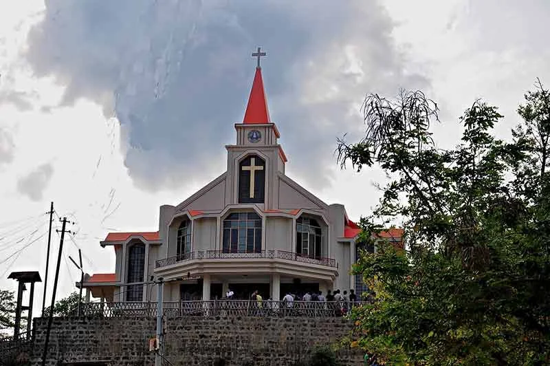
Fiangpui Garden, situated on a hill, is known for its greenery and scenic surroundings. It is a peaceful place for visitors who enjoy gardens and elevated viewpoints.
Old Circuit House
The Old Circuit House is a heritage structure associated with the British colonial period. It is known for its old architectural character and scenic location.
The building and its surroundings offer views of the valley and the Borail Range. It provides a glimpse into the administrative history of the region.
Seikal Bung
Seikal Bung is a hill destination associated with nature tourism and outdoor activities. Its elevated landscape and surrounding greenery make it interesting for visitors who enjoy trekking, camping and exploring less-developed natural destinations.
Visitors should check local accessibility and camping arrangements before planning a trip.
Thuruk
Thuruk is another interesting destination in Dima Hasao. The district administration describes it as a place known for particularly low temperatures due to its elevation and surrounding topography.
Its cool atmosphere and natural surroundings make it an interesting destination for travellers exploring the lesser-known hill areas of Assam.
Transport and Connectivity
Dima Hasao is connected to other parts of Assam through road and railway networks. However, because of its mountainous terrain, travelling through the district can take longer than travelling similar distances in the plains.
Roadways: Haflong is connected to Silchar, Guwahati and other parts of Assam through road networks. National Highway and state highways provide access to different towns and villages. Road conditions may vary, particularly during the monsoon season.
Railways: Haflong Railway Station is an important railway station in the district. It lies on the scenic Lumding–Badarpur railway route, which passes through tunnels, bridges and beautiful mountain landscapes. The railway journey is also an attraction for visitors.
Airways: Silchar Airport is one of the nearest airports for visitors travelling to Haflong. Travellers can continue their journey by road. The actual travel time depends on road conditions and the route selected.
Best Time to Visit Dima Hasao
Dima Hasao can be visited throughout much of the year, but the experience changes with the seasons.
- October to March: A popular period for sightseeing, exploring Haflong, visiting historical sites and enjoying the pleasant weather.
- April to June: The hills remain green, and visitors can explore the natural attractions, although temperatures may rise.
- July to September: The monsoon brings lush greenery and flowing waterfalls. However, heavy rainfall can cause landslides, road disruptions and dangerous river conditions.
For comfortable sightseeing and outdoor activities, October to March is generally a suitable period. Visitors should check local weather and road conditions before travelling.
Conclusion
Dima Hasao is a remarkable part of Assam where natural beauty, historical heritage and indigenous cultures come together. From the green hills of Haflong and the mysterious bird phenomenon of Jatinga to the waterfalls of Panimur and the historical remains of Maibong, the district offers many experiences for travellers.
Its diverse tribal communities, traditional festivals, rivers, forests and mountain landscapes make it an important destination for understanding the cultural and geographical richness of Northeast India.
With responsible tourism, better connectivity and conservation of its natural resources, Dima Hasao has considerable potential to become an important eco-tourism destination in Assam.
Frequently Asked Questions (FAQs) About Dima Hasao
1. Where is Dima Hasao located?
Dima Hasao is a hill district located in the southern part of Assam in Northeast India.
2. What was the former name of Dima Hasao?
Dima Hasao was formerly known as North Cachar Hills. It was officially renamed in 2010.
3. What is Dima Hasao famous for?
Dima Hasao is famous for its scenic hills, tribal cultures, waterfalls, biodiversity, Haflong hill station and the mysterious bird phenomenon of Jatinga.
4. Which is the only hill station in Assam?
Haflong, the headquarters of Dima Hasao district, is widely recognised as the only hill station in Assam.
5. What is the highest peak in Dima Hasao?
Thumjang Peak is the highest peak in Dima Hasao, with an elevation of approximately 1,866 metres.
6. Which river flows through Dima Hasao?
The Kopili River is one of the major rivers flowing through Dima Hasao. Other important rivers include the Mahur, Jatinga, Langting and Diyung.
7. Which tribes live in Dima Hasao?
Major indigenous communities include Dimasa, Zeme Naga, Hmar, Kuki, Biate, Hrangkhol and Karbi, among others.
8. Why is Jatinga famous?
Jatinga is famous for a seasonal bird-disorientation phenomenon in which certain birds are attracted to artificial lights under particular weather and visibility conditions.
9. Which historical kingdom was associated with Maibong?
Maibong was an important capital of the Dimasa Kachari Kingdom.
10. Which waterfall is known as the Niagara of Northeast India?
Panimur Waterfall on the Kopili River is popularly known by this name because of its beautiful cascades and rocky surroundings.