


Assam Geography Important One-Liner GK Questions

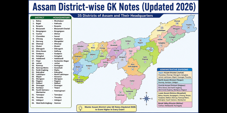
Assam Geography is one of the most important subjects for competitive exams like APSC, ADRE, Assam Police, Assam TET, Grade III, Grade IV, SSC, Railway, Banking, and other government recruitment exams. Questions are often asked about Assam’s rivers, hills, climate, forests, wildlife, minerals, districts, national parks, and important geographical features. Learning one-liner questions with answers is a quick and effective way to revise important facts and improve your exam preparation. This collection covers the most frequently asked Assam Geography questions to help you strengthen your General Knowledge.
1. Which larger tectonic zone includes the Cachar Fold Belt of Assam?
Answer: Indo-Burmese Orogenic Belt

2. Which city in Assam falls under the highest earthquake damage potential (Seismic Zone V)?
Answer: Guwahati
3. Dihing Patkai National Park is mainly located in which two districts?
Answer: Dibrugarh and Tinsukia
4. What is the local name of the strong pre-monsoon wind in Assam?
Answer: Bordoichila
5. Near which place is the Brahmaputra River deepest within Assam?
Answer: Near Dhubri
6. Which river supports the highest density of riverine island (char) agriculture in Assam?
Answer: Brahmaputra
7. What does the Sutargaon Gap refer to?
Answer: A corridor between Karbi Anglong and North Cachar Hills
8. Which town in Assam has a Geomagnetic Observatory?
Answer: Guwahati
9. Which physiographic zone in Assam is highly vulnerable to landslides due to river erosion?
Answer: Bhabar Zone
10. The Bodo Belt mainly refers to which region of Assam?
Answer: North Bank Brahmaputra Plain west of the Manas River
11. What are the Chapari lands of Assam?
Answer: Elevated fluvial terraces
12. Between which two districts is Phulbari Island formed during floods?
Answer: Goalpara and Dhubri
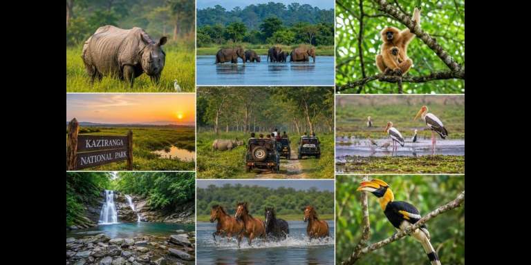
13. What is the natural grassland ecosystem of Kaziranga called?
Answer: Tall Wet Savanna
14. Which strategic mineral is found in Karbi Anglong?
Answer: Sillimanite
15. Sadiya is located at the confluence of which three rivers?
Answer: Dibang, Lohit and Brahmaputra
16. Where is Assam’s only petrified fossil wood site located?
Answer: Umrangso
17. Which district has the largest freshwater swamp forest in Assam?
Answer: Tinsukia
18. Khumtai Reserve is famous for what?
Answer: Tea Germplasm
19. Which river forms the boundary between Karbi Anglong and Dima Hasao?
Answer: Kapili River
20. Nambor Doigrung is famous for what?
Answer: Important Bird and Biodiversity Area (IBA)
21. What is Sonai Rupai?
Answer: A Wildlife Sanctuary in Sonitpur
22. Which district contains the easternmost point of Assam?
Answer: Tinsukia
23. Where is the Brahmaputra Basin widest in Assam?
Answer: Dhubri
24. Which protected area forms part of the Eastern Himalayan Endemic Bird Area?
Answer: Nameri National Park
25. The Ranganadi Hydroelectric Project is located in which district?
Answer: Lakhimpur
26. Which wetland of Assam is known for seasonal floating vegetation?
Answer: Son Beel
27. Tinsukia is globally known for conserving which critically endangered bird?
Answer: White-winged Duck
28. Bherjan-Borajan-Padumoni Wildlife Sanctuary is notable for what?
Answer: Three fragmented patches of protected forest
29. Doyang River is a major tributary of which river?
Answer: Dhansiri River
30. Which district lies immediately north of the Barail Range?
Answer: Dima Hasao
31. Why is Sivasagar geologically significant?
Answer: It is situated on a petroleum-rich anticline.
32. Which place in Assam recorded one of the state’s highest single-day rainfalls?
Answer: Haflong
33. What is the main source of irrigation in Lower Assam?
Answer: Rain-fed canals (Beel Irrigation)
34. Which mineral is extracted along with coal in the Makum Coalfields?
Answer: China Clay
35. Katakhal Valley is famous for what?
Answer: Wet rice cultivation and bamboo settlements
36. Which river supports the traditional Charwa cattle herding system?
Answer: Brahmaputra River
37. What is the dominant soil in the alluvial fans at the foot of the Naga Hills?
Answer: Micaceous Sandy Loam
38. Which protected area has the highest diversity of wild orchids in Assam?
Answer: Dehing Patkai National Park
39. Which district is famous for commercial Bogori (Indian Jujube) orchards?
Answer: Barpeta
40. What is the unique tableland found in Dima Hasao?
Answer: Haflong Tableland
41. Assam’s largest productive beel is famous for which fishery?
Answer: Commercial Eel Fishery
42. What are the Charaideo Maidams?
Answer: Ahom Royal Burial Mounds
43. Which forest type dominates the Barail Range?
Answer: Moist Sub-Tropical Evergreen Forest
44. Which hill range is prone to frequent landslides affecting railway lines?
Answer: Barail Range
45. What do the Bodo Hills (Duars) refer to?
Answer: Himalayan foothills along the Bhutan-Assam border
46. Which river originates from the Jampui Hills?
Answer: Longai River
47. The Patkai Range mainly consists of rocks from which geological period?
Answer: Tertiary Period
48. What is the traditional Haduk system of Goalpara?
Answer: Group fishing using funnel-shaped nets
49. Which district is crossed by India’s Standard Meridian (82°30′E)?
Answer: Goalpara
50. What is Maar (Mar) land in Assam?
Answer: Heavy clay floodplain soil suitable for winter crops
51. Which district has its headquarters at Silapathar?
Answer: Dhemaji
52. Which mineral is used in making crockery and sanitary ware?
Answer: Kaolin
53. Assam shares international borders with which two countries?
Answer: Bhutan and Bangladesh
54. Which district had the highest population in the 2011 Census?
Answer: Nagaon
55. Which mountain pass connects Assam with Arunachal Pradesh?
Answer: Sela Pass
56. What type of drainage pattern is found on the Karbi Anglong Plateau?
Answer: Radial Drainage
57. In which year was Oil India Limited incorporated?
Answer: 1959
58. Which two tectonic plates meet near Assam?
Answer: Indian Plate and Eurasian Plate
59. Which district has its headquarters at Tinsukia?
Answer: Tinsukia
60. Which Assam district shares its southern boundary with Meghalaya?
Answer: Karbi Anglong
61. Assam lies mainly in which seismic zone?
Answer: Seismic Zone V
62. Which are the oldest rocks found in Assam?
Answer: Gneisses
63. Manas River is a tributary of which major river?
Answer: Brahmaputra
64. Which place in Assam is famous for coal mining?
Answer: Margherita
65. Which river flows north of Kaziranga National Park?
Answer: Jia Bharali River
66. Which river forms the western boundary of Assam’s Brahmaputra Valley?
Answer: Sonkosh River
67. Which district has its headquarters at Hailakandi?
Answer: Hailakandi
68. Which river valley has a horseshoe-shaped terrain?
Answer: Barak Valley
69. Which mineral found in Assam is important for the glass industry?
Answer: Quartz
70. In which year did coal mining begin in Assam?
Answer: 1828
71. Which town serves as the headquarters of Dhemaji district?
Answer: Dhemaji
72. Which plateau lies between the Brahmaputra and Barak valleys?
Answer: Karbi Anglong Plateau
73. Which river originates in Nagaland and flows through Barak Valley?
Answer: Barak River
74. What is the headquarters of Sonitpur district?
Answer: Tezpur
75. During which season does the northeast monsoon bring rainfall?
Answer: Retreating Monsoon
76. Which is the southernmost district of Assam?
Answer: Karimganj
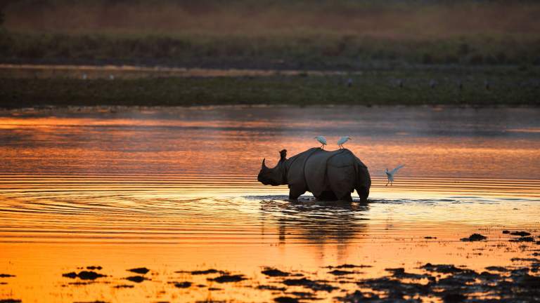
77. Which animal is Kaziranga National Park famous for protecting?
Answer: One-horned Rhinoceros
78. The floodplains of the Brahmaputra are mainly composed of which type of soil?
Answer: Alluvial Soil
79. Which tributary of the Barak River is known for flash floods?
Answer: Jinari River
80. Which Assam district is famous for its whisky industry?
Answer: Jorhat
81. What is the headquarters of Cachar district?
Answer: Silchar
82. Which district is situated along the Barak River?
Answer: Cachar
83. Which season records the lowest temperatures in Assam?
Answer: Winter
84. What is the average summer temperature range in Assam?
Answer: 30°C-33°C
85. Which district lies at the extreme eastern end of Assam?
Answer: Tinsukia
86. Which forest type is dominant in Karbi Anglong?
Answer: Mixed Deciduous Forest
87. Which town is home to Asia’s oldest operating oil refinery?
Answer: Digboi
88. Which river is most responsible for bank erosion in Assam?
Answer: Brahmaputra River
89. Which district has its headquarters at Nalbari?
Answer: Nalbari
90. Which district lies near the confluence of the Brahmaputra and Dhansiri rivers?
Answer: Sivasagar
91. Diphu is the headquarters of which district?
Answer: Karbi Anglong
92. Which mineral is mined from the Dholamara Hills of Goalpara?
Answer: Mica
93. What is the main cause of erosion in Majuli Island?
Answer: Shifting channels of the Brahmaputra River
94. Which district lies entirely on the Barak Plain?
Answer: Cachar
95. What is the characteristic landscape of the Tarai Zone in Assam?
Answer: Marshy and swampy lands
96. Which mineral resource is found in the Ledo-Jaipur Coalfields?
Answer: Coal
97. Dudhnoi River tributaries are mainly found in which district?
Answer: Goalpara
98. Which type of rainfall is most common in Assam?
Answer: Orographic Rainfall
99. Manas National Park is part of which Biosphere Reserve?
Answer: Manas Biosphere Reserve
100. Which river flows through central Assam before joining the Brahmaputra?
Answer: Dikhow River
Regular practice of Assam Geography one-liner questions helps improve memory, speed, and accuracy in competitive exams. Revise these important questions frequently and focus on key topics such as rivers, districts, national parks, climate, minerals, and geographical features of Assam. Consistent revision will boost your confidence and increase your chances of scoring well in the General Knowledge section of various examinations.