



NISAR Satellite ISRO: India and the U.S. Launch Landmark Earth Observation Mission

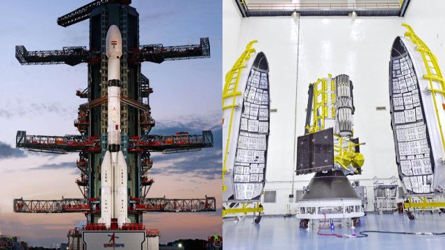
The NISAR Satellite ISRO collaboration marks a groundbreaking achievement in international space exploration and environmental science. India and the United States have reached a historic milestone as the NASA-ISRO Synthetic Aperture Radar (NISAR) satellite officially becomes operational on November 7. This joint Earth observation mission, developed by NASA and ISRO, represents one of the most advanced efforts ever undertaken to monitor Earth’s surface dynamics, climate systems, and natural hazards with unprecedented accuracy.
Thank you for reading this post, don't forget to subscribe!Announcing the operational readiness of the satellite, ISRO Chairman V. Narayanan confirmed that all calibration and validation procedures have been successfully completed. Following a scheduled conclave this week, the NISAR mission will begin full-scale data acquisition and distribution, ushering in a new era of space-based Earth observation.
NISAR Satellite ISRO: A Milestone in Indo-US Space Cooperation
The NISAR Satellite ISRO mission symbolizes the growing strength of space collaboration between India and the United States. Jointly developed by the Indian Space Research Organisation (ISRO) and the National Aeronautics and Space Administration (NASA), NISAR is the first major Earth observation mission co-built by the two nations.
Weighing approximately 2,400 kilograms, the satellite was launched on July 30 from the Satish Dhawan Space Centre aboard ISRO’s GSLV (Geosynchronous Satellite Launch Vehicle) rocket. This joint effort brings together NASA’s technological innovation and ISRO’s cost-effective and reliable space engineering, combining their strengths to produce a mission that could revolutionize global Earth monitoring capabilities.
The mission aims to enhance the world’s ability to track climate change, natural disasters, and environmental degradation by offering precise, repeatable, and consistent radar-based measurements of Earth’s surface. Its vast data sets will be used by global researchers to study the changing dynamics of ecosystems, ice sheets, forests, and agriculture.
NISAR Satellite ISRO: Advanced Radar Technology for Earth Observation
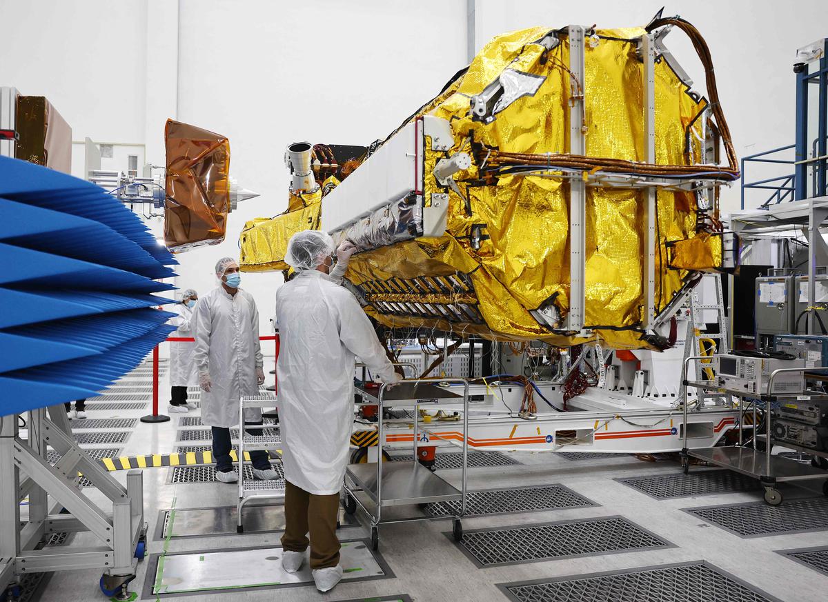
The NISAR Satellite ISRO project represents a technological marvel in radar imaging science. It is the world’s first satellite mission to carry dual-frequency Synthetic Aperture Radar (SAR) systems, combining NASA’s L-Band radar and ISRO’s S-Band radar instruments on a single platform.
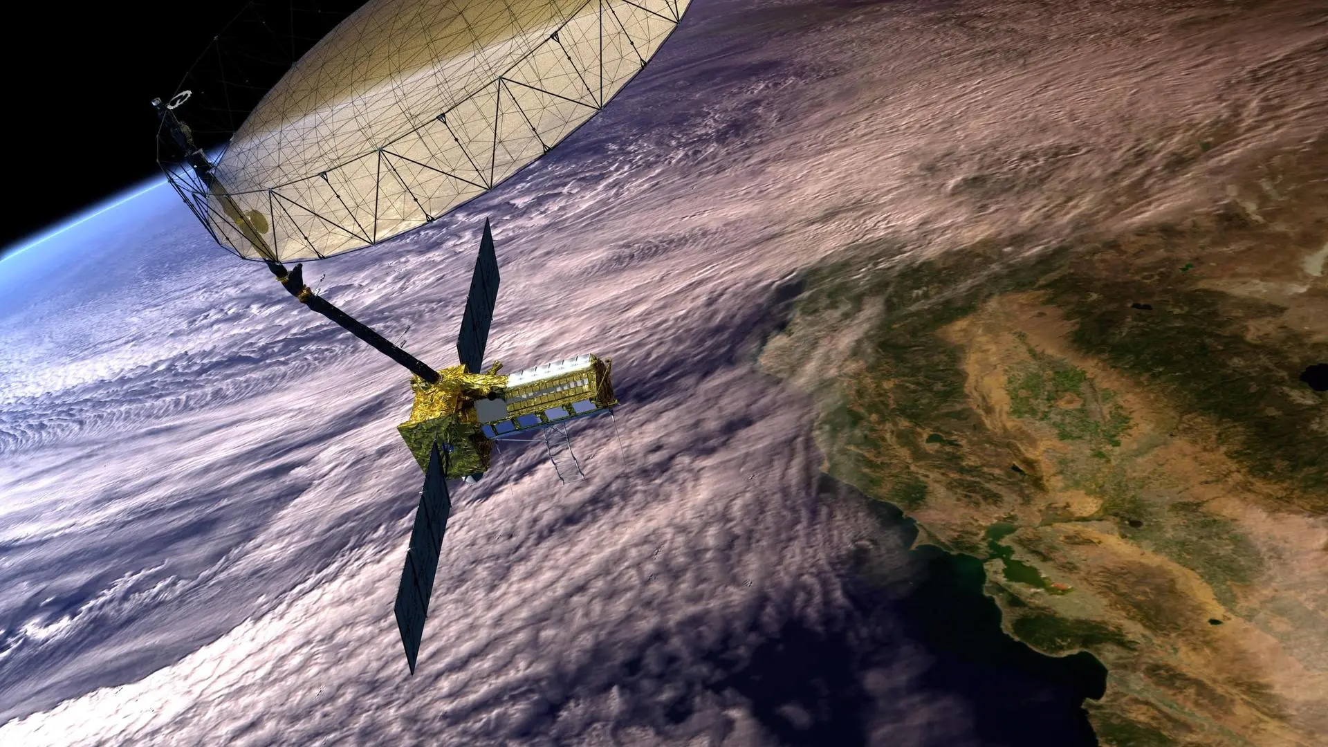
- L-Band Radar (NASA): Capable of penetrating forest canopies and snow layers, this radar helps in studying soil moisture, forest biomass, and ice sheet dynamics. It provides detailed insight into large-scale environmental and geological processes.
- S-Band Radar (ISRO): Designed for high-resolution surface imaging, the S-Band sensor tracks agricultural patterns, small vegetation, wetland dynamics, and snow cover variations.
Together, these instruments can collect data day and night, irrespective of cloud cover, rainfall, or weather conditions. This capability allows scientists to continuously monitor surface deformation, land use changes, and ecosystem responses to natural and human-induced activities.
NISAR Satellite ISRO: Scientific and Environmental Applications
The NISAR Satellite ISRO mission is expected to transform the field of Earth observation and climate research. By scanning nearly the entire land and ice surfaces of the planet twice every 12 days, it will provide one of the most comprehensive data sets ever collected by a space-based radar mission.
Its data will have wide-ranging scientific and societal applications:
- Climate Change Monitoring: NISAR will track glacier movement, ice melting patterns, and forest carbon storage, offering critical insights into the pace of global warming.
- Natural Disaster Management: The satellite’s radar images can detect minute shifts in the Earth’s crust, helping predict earthquakes, landslides, and volcanic activities before they escalate.
- Agricultural and Water Management: By monitoring soil moisture, crop growth, and seasonal water flow, NISAR will aid policymakers in optimizing irrigation and food security strategies.
- Urban and Infrastructure Planning: Its ability to detect ground subsidence and land deformation will help authorities plan safer urban infrastructure in rapidly expanding cities.
The satellite’s data will be made available to researchers and government agencies worldwide, enabling global collaboration in climate science, agriculture, and environmental management.
NISAR Satellite ISRO: Global Impact and Data Sharing
One of the key strengths of the NISAR Satellite ISRO mission is its open-data policy. Both NASA and ISRO will share the satellite’s information freely with international organizations, research institutions, and governments.
The mission’s data will contribute to global efforts such as the United Nations Sustainable Development Goals (SDGs), particularly in areas related to climate action, life on land, and sustainable cities. NISAR’s observations will also support global agencies like the Intergovernmental Panel on Climate Change (IPCC) and World Meteorological Organization (WMO) in updating predictive climate models.
For India, this data will complement national initiatives such as the National Remote Sensing Programme and Digital India’s Geospatial Data Infrastructure, enhancing the country’s capacity to respond to environmental and agricultural challenges.
NISAR Satellite ISRO: ISRO’s Upcoming Missions and Future Goals
While NISAR strengthens Earth observation, ISRO continues to expand its space exploration portfolio with a series of ambitious projects. The agency is preparing for the Gaganyaan mission, India’s first human spaceflight program, with an uncrewed test flight scheduled for January 2026. This will pave the way for the first Indian astronauts to orbit Earth by 2027.
To ensure astronaut safety, ISRO has conducted over 8,000 tests on crew modules, life support systems, and re-entry mechanisms. Alongside this, India is also progressing toward the establishment of its own space station, known as the “Bhartiya Antariksh Station.” The first module of this orbital facility is expected to be launched by 2028, with full operational capacity comprising five modules targeted by 2035. The station will host up to six astronauts, enabling long-duration space missions and research in microgravity environments.
The success of NISAR strengthens India’s position as a key player in global space research and reaffirms its capability to undertake complex international collaborations.
NISAR Satellite ISRO: Strengthening Global Climate Observation
The operational launch of the NISAR Satellite ISRO mission signifies a major step forward for both India and the United States in addressing the global challenges of climate change and environmental degradation. As a fusion of cutting-edge radar technology and international scientific collaboration, NISAR will provide crucial insights into how our planet’s land and ice systems are evolving.
Its data will not only help in scientific advancement but will also guide global efforts toward sustainable resource management, disaster resilience, and climate adaptation. In the coming years, the success of NISAR is expected to shape how nations monitor, understand, and protect Earth’s fragile ecosystems proving once again that space science, when shared, becomes a tool for the planet’s collective survival.