


NISAR Antenna Deployment Marks New Science Phase

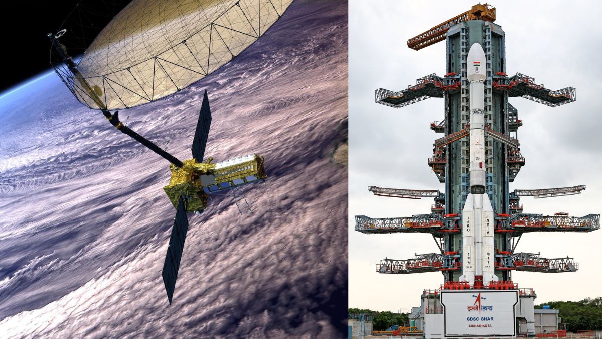
NISAR Antenna Deployment has become a major highlight in global space research as the NASA–ISRO Synthetic Aperture Radar mission crossed a significant milestone. The successful unfolding of its massive 12-metre antenna reflector officially marks the beginning of the satellite’s operational science phase. Launched on the GSLV-F16 rocket in July 2025, NISAR is now sending high-resolution radar data that will play an important role in understanding Earth’s surface, natural resources and environmental changes.
Thank you for reading this post, don't forget to subscribe!The mission, jointly developed by NASA and ISRO, is one of the world’s most advanced Earth-observation projects. Designed to observe the planet in both L-Band and S-Band radar frequencies, it aims to deliver consistent, reliable and precise information about land surfaces, forests, coastlines, ice sheets, agricultural zones and much more. With the antenna now fully deployed in orbit, the mission has entered a crucial phase where scientific data collection begins at full scale.
NISAR Antenna Deployment Begins Space Operations
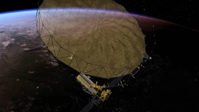
The heart of the latest achievement is the successful deployment of the giant antenna, a key part of the satellite’s radar imaging system. The antenna, built by NASA, was launched in a folded position attached to a nine-metre boom. After reaching its orbit, engineers initiated a carefully timed multi-stage deployment sequence.
Joint NASA–ISRO operations began on 9 August 2025. The deployment included several critical steps, each involving complex mechanical components such as the wrist, shoulder, elbow and root mechanisms. Over the course of five days, these segments unfolded exactly as planned. By 15 August, the antenna reflector reached its full 12-metre diameter, and all systems confirmed successful activation. Engineers on the ground described the operation as smooth and precise, demonstrating the strong coordination between the two space agencies.
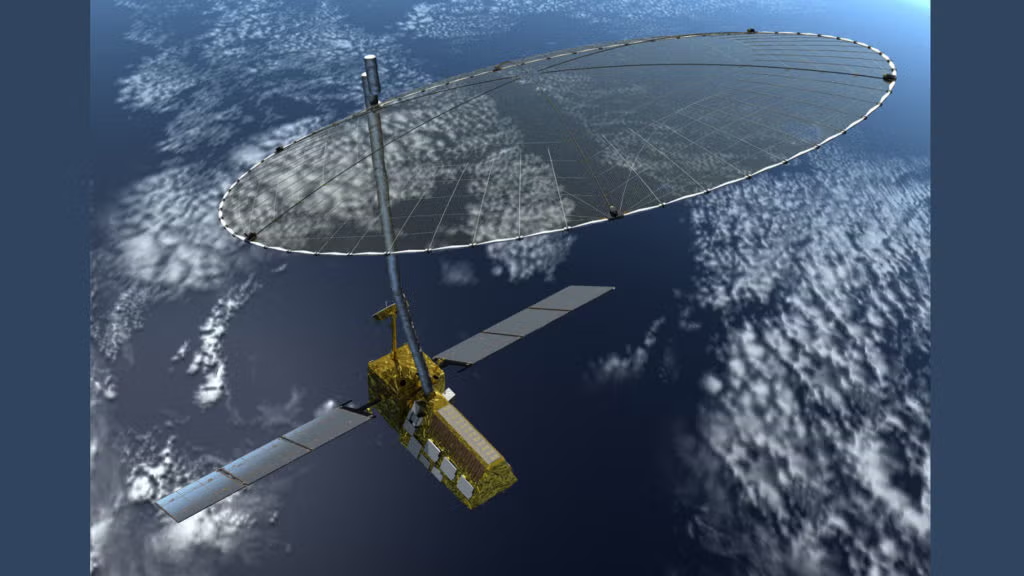
This large antenna is essential because it allows NISAR to generate high-resolution radar images across wide regions. The stable deployment in orbit ensures that the mission can operate at maximum performance for global observation.
NISAR Antenna Deployment Leads to First S-Band Images
With the antenna fully deployed, NISAR quickly began collecting its first radar images. On 19 August 2025, the satellite captured its initial S-Band Synthetic Aperture Radar image, revealing the fertile Godavari River Delta.
The image displayed clear details of different land surfaces. Mangrove forests, agricultural zones and aquaculture ponds appeared sharply, reflecting the high sensitivity and resolution of the S-Band system. Scientists noted that the clarity of these early images demonstrates NISAR’s ability to observe landscape patterns, coastline features and delta dynamics, even in areas with thick vegetation.
This first set of data is an encouraging start for future monitoring of river basins, crop fields and coastal ecosystems. It shows how the mission can help track seasonal changes, flood patterns and soil moisture with remarkable precision.
NISAR Antenna Deployment Supports Calibration Work
Early operations also included extensive calibration activities to enhance data quality. ISRO placed several reference targets near Ahmedabad and other selected regions across India to confirm radar accuracy. These reference zones help in adjusting the radar’s measurements to ensure that every pixel of data matches real-world locations.
In addition, NISAR recorded datasets from the Amazon rainforest, one of the world’s most complex natural environments. The dense forest canopy is an ideal testing ground for fine-tuning radar parameters such as spacecraft pointing, signal strength and imaging angles. These calibration efforts improved the performance of both S-Band and L-Band systems.
By refining acquisition settings and verifying data over different terrains, the mission is now equipped to provide high-quality information across global validation sites. This phase ensures that researchers, government agencies and environmental organizations will receive trustworthy radar insights for long-term studies.
NISAR Antenna Deployment Expands Earth Science Applications
As the mission moves into regular operation, NISAR’s potential across Earth science sectors is already becoming clear. The satellite captures radar images frequently and consistently, allowing scientists to track rapid environmental changes and long-term trends.
Agriculture and Food Security
NISAR radar data helps monitor crop growth, soil conditions and water availability. This information supports better planning for farming activities and resource management.
Forestry and Biodiversity
The mission can map forest cover, detect deforestation and measure biomass changes. These insights help in protecting natural habitats and understanding carbon storage.
Hydrology and Water Systems
NISAR tracks river flows, wetlands, reservoirs and flood-prone zones. Such data plays a key role in water management and disaster preparedness.
Geoscience and Surface Movement
The radar can detect tiny movements in Earth’s crust, which helps scientists study landslides, land subsidence and ground deformation.
Polar and Ice Studies
NISAR monitors polar regions, tracking glacier movements and ice-sheet changes. This information is crucial for understanding global sea-level trends.
Oceanography and Coastal Monitoring
The satellite observes coastal erosion, wave patterns and shoreline shifts, providing valuable support to marine research.
With these capabilities, NISAR positions India and the global research community for more accurate climate understanding, improved disaster management and sustainable resource planning.
NISAR Antenna Deployment Strengthens Global Collaboration
The mission represents a significant partnership between NASA and ISRO. The combination of NASA’s L-Band SAR system and ISRO’s S-Band SAR has created one of the world’s most advanced dual-frequency radar satellites. The antenna deployment marks the moment where this technological collaboration begins producing real scientific benefits. Regular imaging of the Indian landmass and global sites is set to support an international network of environmental scientists and institutions.