

Earth Sciences: Cyclones, Weather and Ocean Research

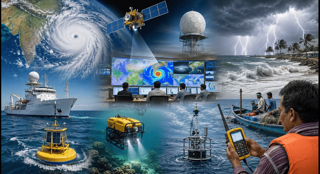
The Ministry of Earth Sciences played a major role in improving India’s weather forecasting, cyclone monitoring, ocean research, and disaster preparedness. During 2019, India witnessed an unusual number of cyclones affecting both its eastern and western coasts. The Ministry strengthened early warning systems, introduced new technologies for fishermen, promoted climate-smart agriculture, and expanded research on oceans and maritime resources.
Thank you for reading this post, don't forget to subscribe!The Ministry of Earth Sciences (MoES) works to understand the Earth’s atmosphere, oceans, weather, climate, and geological processes. Its research helps protect lives, improve agriculture, support fisheries, and strengthen India’s preparedness against natural disasters.
What is the Ministry of Earth Sciences?
The Ministry of Earth Sciences (MoES) is responsible for studying Earth’s atmosphere, oceans, weather, climate, earthquakes, and marine resources.
The ministry supervises several important organizations, including:
- India Meteorological Department (IMD)
- Indian National Centre for Ocean Information Services (INCOIS)
- National Institute of Ocean Technology (NIOT)
- National Centre for Polar and Ocean Research (NCPOR)
- Indian Institute of Tropical Meteorology (IITM)
Its main objective is to improve weather forecasting, disaster warning systems, ocean exploration, and climate research.
2019: A Remarkable Year for Cyclones
According to the India Meteorological Department (IMD), 2019 was one of the most unusual cyclone years in India’s history.
Both the Bay of Bengal and the Arabian Sea experienced several powerful cyclones.
Major cyclones included:
- Cyclone Pabuk
- Cyclone Fani
- Cyclone Vayu
- Cyclone Hikaa
- Cyclone Bulbul
- Cyclone Kyarr
- Cyclone Maha
- Cyclone Pawan
One of the biggest surprises was the unusually high number of cyclones in the Arabian Sea, which is normally less active than the Bay of Bengal.
Scientists observed that such intense cyclone activity had occurred only a few times during the past century.
Why Do Tropical Cyclones Form?
A tropical cyclone is a powerful storm that develops over warm ocean waters.
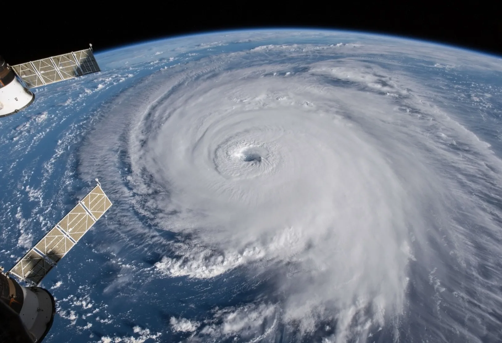
Several conditions help cyclones form:
- Warm sea surface temperatures
- High humidity
- Low atmospheric pressure
- Moist air
- Suitable wind patterns
- Rotation caused by Earth’s movement
When warm ocean water evaporates, it absorbs heat from the sea. As the water vapour rises and cools, it releases this heat into the atmosphere.
This released heat makes the surrounding air rise further, creating an area of low pressure. More air rushes toward the centre, causing the storm to become stronger.
This continuous cycle allows cyclones to grow into severe storms.
Arabian Sea Became More Active
Normally, the Bay of Bengal produces more cyclones than the Arabian Sea.
However, in 2019, the Arabian Sea experienced five major cyclones:
- Vayu
- Hikaa
- Kyarr
- Maha
- Pawan
The Bay of Bengal produced only:
- Pabuk
- Fani
- Bulbul
Scientists linked this unusual trend to warmer sea surface temperatures and changing climate conditions.
This highlighted the growing influence of climate change on cyclone patterns.
Cyclone Fani: One of India’s Strongest Storms
Cyclone Fani was among the strongest storms to hit India’s eastern coast.
It made landfall near Odisha in May 2019.
The cyclone caused:
- Heavy rainfall
- Strong winds
- Damage to houses
- Power outages
- Crop losses
However, due to accurate weather forecasts and timely evacuation by the government, thousands of lives were saved.
The successful management of Cyclone Fani became an example of effective disaster preparedness.
Improved Cyclone Forecasting
The Ministry of Earth Sciences continued improving weather forecasting through advanced technology.
Modern forecasting now uses:
- Weather satellites
- Doppler Weather Radars
- Ocean observation systems
- Supercomputers
- Artificial Intelligence-based forecasting models
- Numerical Weather Prediction models
These technologies help authorities issue warnings several days before a cyclone makes landfall.
Early warnings reduce damage and save lives.
GEMINI Device for Fishermen
One of the major achievements in 2019 was the launch of the GAGAN Enabled Mariner’s Instrument for Navigation and Information (GEMINI).
This portable communication device was developed mainly for fishermen.
Features
The device provides:
- Cyclone warnings
- Tsunami alerts
- Ocean state forecasts
- Potential Fishing Zone (PFZ) information
- Weather updates
- Emergency communication
Even when mobile networks are unavailable in the sea, GEMINI can receive important messages through satellites.
This greatly improves the safety of fishermen.
What is GAGAN?
GEMINI works using the GPS Aided Geo Augmented Navigation (GAGAN) satellite system.
GAGAN was jointly developed by:
- Indian Space Research Organisation (ISRO)
- Airports Authority of India (AAI)
It uses Indian GSAT satellites to provide accurate navigation services.
The system covers the entire Indian Ocean region throughout the day.
Role of INCOIS
The Indian National Centre for Ocean Information Services (INCOIS) is an important organization under the Ministry.
It provides valuable information on:
- Ocean conditions
- Tsunami warnings
- Potential Fishing Zones
- Ocean currents
- High waves
- Cyclone forecasts
Its services help fishermen improve their catch while ensuring their safety.
Advances in Agro Meteorology
In 2019, India hosted the International Symposium on Advances in Agro Meteorology (INAGMET-2019).
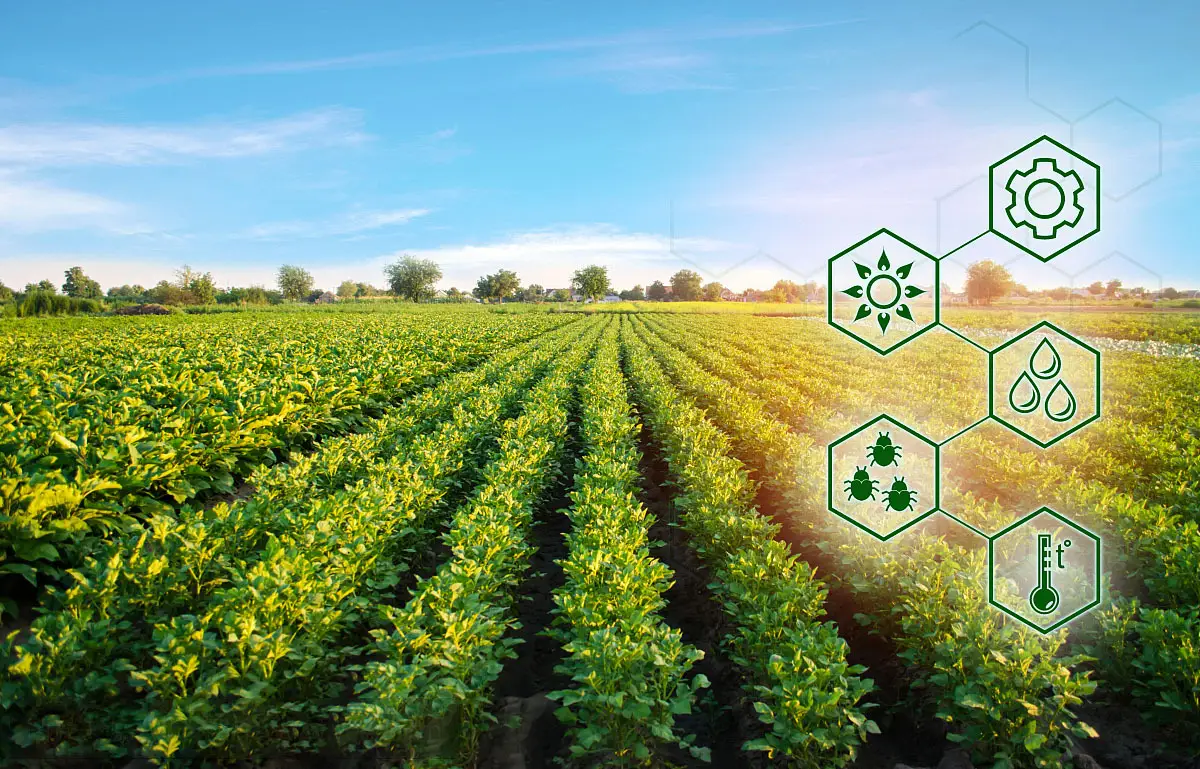
Agro Meteorology studies the relationship between weather and agriculture.
Weather directly affects:
- Crop production
- Irrigation
- Soil moisture
- Pest attacks
- Livestock health
Scientists discussed how better weather information can help farmers reduce climate-related risks.
Importance of Agro Meteorology
Weather forecasts allow farmers to:
- Decide sowing dates.
- Plan irrigation.
- Reduce fertilizer losses.
- Protect crops from storms.
- Prepare for droughts.
- Improve crop yields.
Climate-smart farming has become increasingly important because climate change is making weather more unpredictable.
National Institute of Ocean Technology (NIOT)
The National Institute of Ocean Technology (NIOT) celebrated its Silver Jubilee in 2019.
NIOT was established in 1993 under the Ministry of Earth Sciences.
Its mission is to develop Indian technologies for exploring and using ocean resources.
Major Areas of Research
NIOT works in several important areas:
- Deep-sea mining
- Ocean energy
- Underwater robotics
- Desalination technology
- Coastal engineering
- Marine instrumentation
- Offshore structures
These technologies help India utilize marine resources while protecting the environment.
India’s Exclusive Economic Zone (EEZ)
India has a vast Exclusive Economic Zone (EEZ) covering nearly 2.37 million square kilometres.
The EEZ gives India special rights to explore and use marine resources.
These include:
- Fish
- Minerals
- Oil
- Natural gas
- Renewable ocean energy
NIOT develops technologies that help use these resources sustainably.
Maritime Zones Under UNCLOS
The United Nations Convention on the Law of the Sea (UNCLOS), 1982 divides the ocean into different maritime zones.
These include:
Internal Waters
Waters located inside the country’s baseline.
Territorial Sea
Extends up to 12 nautical miles from the coast.
The country exercises full sovereignty here.
Contiguous Zone
Extends up to 24 nautical miles.
The country can enforce laws related to customs, immigration, taxation, and security.
Exclusive Economic Zone (EEZ)
Extends up to 200 nautical miles.
The coastal nation has exclusive rights over natural resources.
High Seas
These waters belong to no single country and remain open to all nations.
Importance of Ocean Research
Ocean research benefits India in many ways.
It supports:
- Weather forecasting
- Cyclone prediction
- Fisheries
- Shipping
- National security
- Climate studies
- Marine biodiversity
- Renewable energy
Better understanding of oceans also helps reduce disaster risks.
Developments After 2019 (2020-2025)
Since 2019, the Ministry of Earth Sciences has made several important advancements.
Better Weather Forecasting
India has improved cyclone track prediction and rainfall forecasting using high-performance supercomputers and artificial intelligence.
Doppler Weather Radar Expansion
More Doppler Weather Radars have been installed across coastal and inland regions to improve real-time weather monitoring.
Mission Mausam
In 2024, the Government announced Mission Mausam, a major initiative to modernize weather forecasting, improve observation systems, enhance climate services, and strengthen disaster preparedness using advanced technologies.
Deep Ocean Mission
The Deep Ocean Mission, approved in 2021, focuses on deep-sea exploration, underwater technology, marine biodiversity, and sustainable use of ocean resources. It also supports India’s efforts to develop a manned submersible for deep-sea research.
Improved Early Warning Systems
India’s tsunami, cyclone, lightning, and heatwave warning systems have become more accurate, helping reduce disaster-related deaths.
Climate Research
The ministry has expanded research on climate change, monsoon variability, glacier studies, and extreme weather events to help governments plan better adaptation strategies.

Challenges Ahead
Despite significant progress, several challenges remain.
These include:
- Climate change
- Rising sea surface temperatures
- Increasing frequency of extreme weather events
- Coastal erosion
- Sea-level rise
- Ocean pollution
- Better disaster preparedness for growing urban populations
Addressing these issues will require continuous scientific research, international cooperation, and public awareness.
Conclusion
The Ministry of Earth Sciences marked an important year in strengthening India’s capabilities in weather forecasting, cyclone monitoring, ocean research, and disaster management. The unusual cyclone activity during the year highlighted the growing impact of climate change and the need for accurate forecasting systems.
Initiatives such as the GEMINI device, improved cyclone warning systems, advances in agro meteorology, and research by organizations like INCOIS and NIOT demonstrated India’s commitment to protecting lives, supporting farmers and fishermen, and promoting sustainable use of marine resources.
From 2020 to 2025, the ministry further expanded its scientific capabilities through Mission Mausam, the Deep Ocean Mission, enhanced weather forecasting technology, and stronger disaster warning systems. As climate-related challenges continue to grow, the Ministry of Earth Sciences will remain central to ensuring India’s resilience, environmental sustainability, and scientific advancement.
FAQs
1. What is the Ministry of Earth Sciences?
The Ministry of Earth Sciences (MoES) is responsible for weather forecasting, climate research, ocean studies, earthquake monitoring, and disaster warning systems in India.
2. Why was 2019 significant for cyclones in India?
The year 2019 witnessed an unusually high number of cyclones affecting both the Bay of Bengal and the Arabian Sea, making it one of the most active cyclone seasons in recent history.
3. What is a tropical cyclone?
A tropical cyclone is a powerful storm that forms over warm ocean waters due to low atmospheric pressure, high humidity, and strong rotating winds.
4. What is the GEMINI device?
The GAGAN Enabled Mariner’s Instrument for Navigation and Information (GEMINI) is a satellite-based communication device that provides fishermen with weather forecasts, cyclone warnings, tsunami alerts, and fishing zone information.
5. What is GAGAN?
GAGAN (GPS Aided Geo Augmented Navigation) is India’s satellite-based navigation system developed by ISRO and the Airports Authority of India to provide accurate positioning and navigation services.
6. What is the role of INCOIS?
The Indian National Centre for Ocean Information Services (INCOIS) provides ocean state forecasts, tsunami warnings, potential fishing zone advisories, and marine weather information to improve coastal safety.
7. What is the National Institute of Ocean Technology (NIOT)?
NIOT is an autonomous organization under the Ministry of Earth Sciences that develops technologies for ocean exploration, deep-sea research, desalination, offshore engineering, and marine resource management.
8. What is the Exclusive Economic Zone (EEZ)?
The Exclusive Economic Zone (EEZ) is a maritime area extending up to 200 nautical miles from a country’s coastline, where it has exclusive rights to explore and use marine resources.
9. What is Mission Mausam?
Mission Mausam is a Government of India initiative launched to modernize weather forecasting, strengthen climate services, improve observation systems, and enhance disaster preparedness using advanced technologies.
10. Why is the Ministry of Earth Sciences important?
The ministry helps protect lives and livelihoods through accurate weather forecasts, cyclone warnings, ocean research, climate studies, disaster preparedness, and scientific research that supports agriculture, fisheries, aviation, and coastal management.